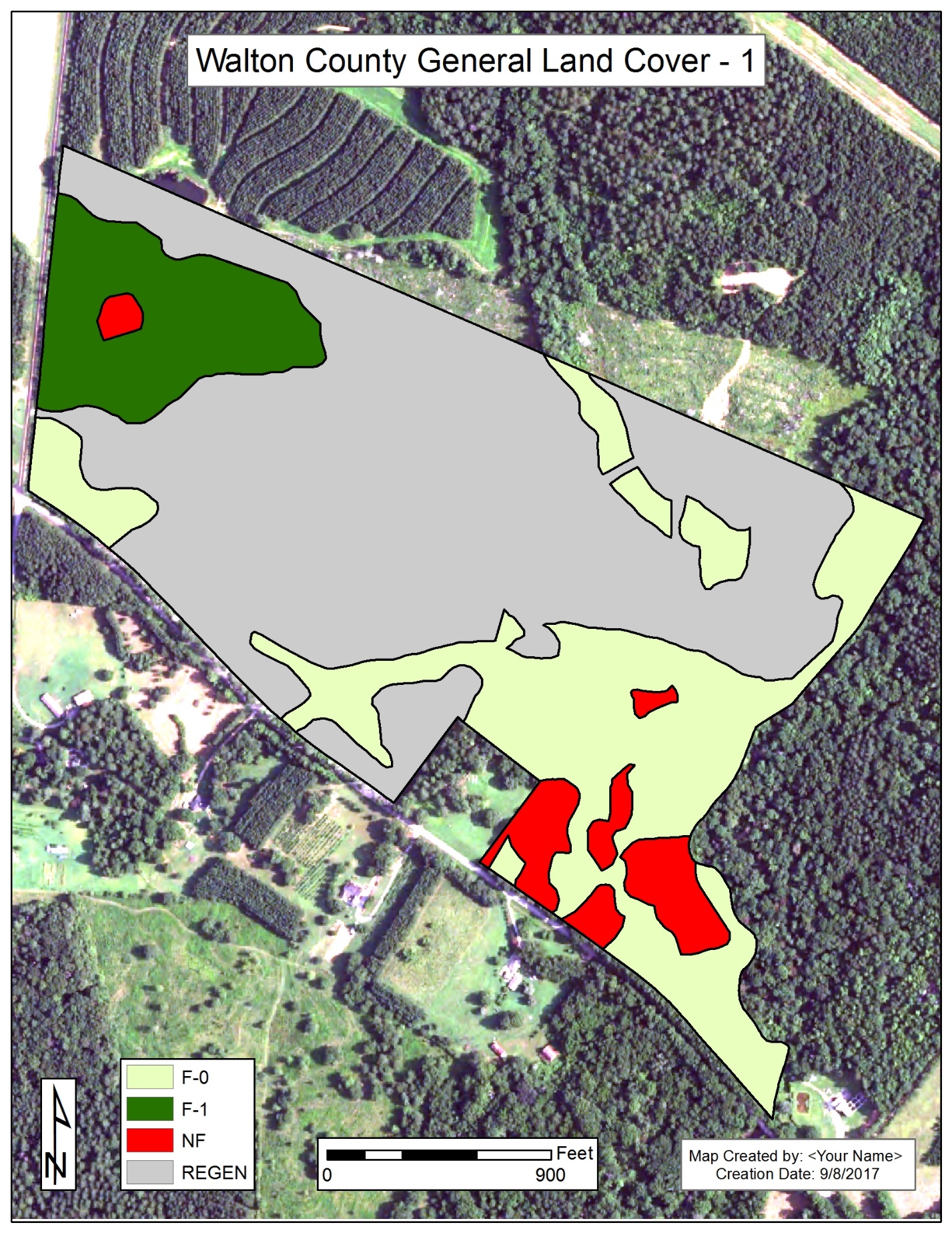
Lab 4: Determine area of forested-0 (planted pine & hardwoods), forested-1 (thinned pine), regeneration, and nonforest types, and generate a map to show where these stands are located.
- To eliminate any confusion (previous mess-ups), I created a lab 4 file geodatabase for you – you will be using the Walton county boundary layer I create.
- Additionally, you need to save any ArcMap work you have on your screen and then CLOSE ArcMap – you will be using a new ArcMap project.
- Create your workspace on the C:\ drive. Call it lab4workspace
- Download the file geodatabase I created for you (download this file geodatabase I created)
- Download this file
- Copy the ZIP file from your Downloads folder to c:\lab4workspace
- Right-click on the ZIP file > Extract All
- MAKE SURE YOUR EXTRACT LOCATION IS C:\LAB4WORKSPACE
- Download the Walton County NAIP 2015 image I have linked at the bottom of the ELC Lecture Documents section
- Copy this file over to c:\lab4workspace
- There is no need to uncompress this file since this file is not zipped
- Close all running instances of ArcMap then start a new instance of ArcMap
- Load the c:\lab4workspace Walton_boundaryUTM17 (inside the file geodatabase) and the clpNAIP2015_Walton.img (downloaded in step 3) into your project.
- Save your project to c:\lab4workspace.
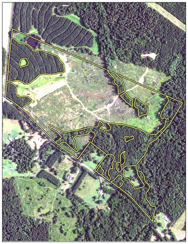
You are now at a point where you are ready to start editing and cut the boundary up into smaller pieces. For this lab, I want you to recreate the “Walton County General Land Cover -1” map (image below) and to report the acreage of each general land cover. Use the delineations I use.