How-To Collect Data with SoloForest and the Flint GPS Units
Information in this document is modified from pdf documents put together by Johnny Thompson, LandMark Systems
Flint Basics
This unit uses a windows operating system and a stylus to navigate
Turn the unit on with the on/off button
Refresh (turn the screen back on) with the center button
The Windows button will take you to the home screen (desktop)
To get started, make sure Solo Forest is NOT already running:
- Click on the Windows button
- Click on Task Manager
- End task on Solo Forest if running
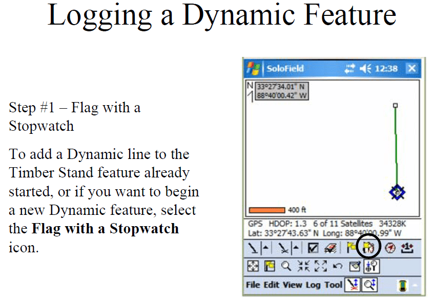
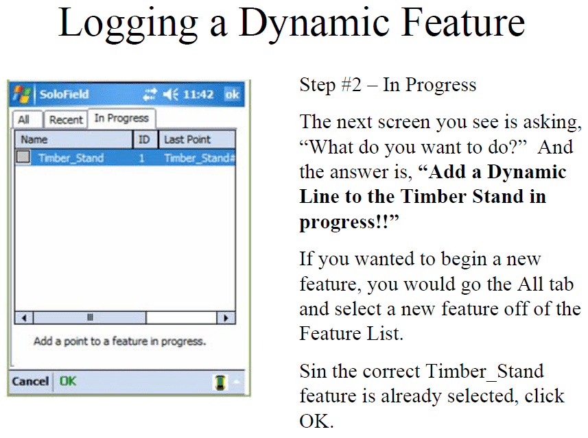
Static Data vs. Dynamic Data
Before you collect data, ask yourself if this vertex is STATIC or DYNAMIC?
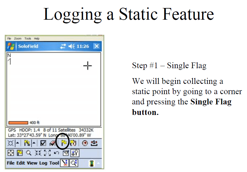
Static = stationary, tasked to gather data
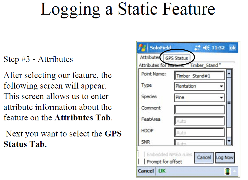
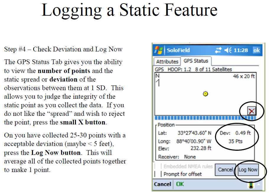
Static data is where you record multiple readings from the satellites and average them together into one well-defined vertex. Static data can be stored in a point feature, line feature, or polygon feature.
Dynamic = in motion, continuously gathered
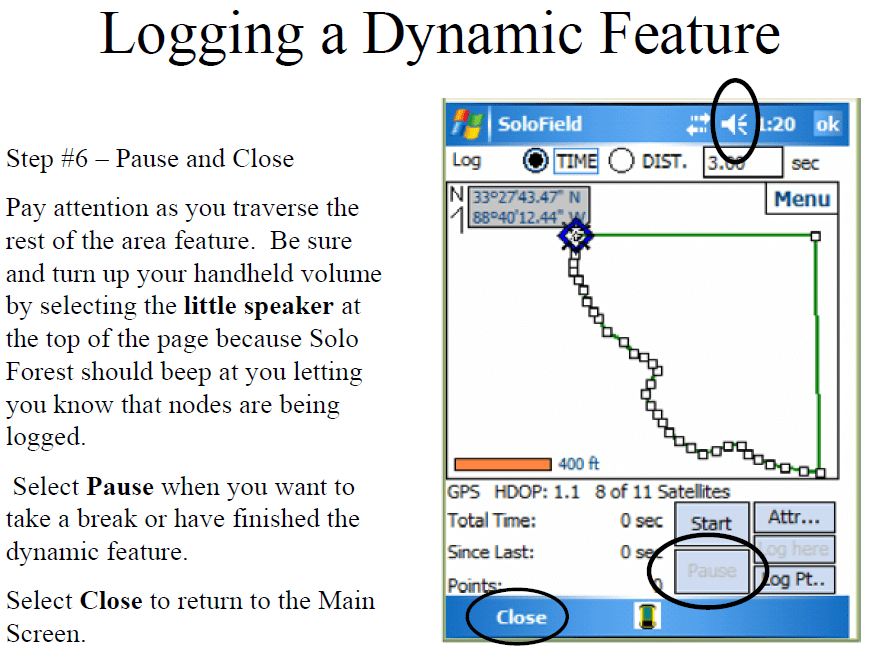
Dynamic data should only be stored in line or polygon features.
Procedures
- Start SoloForest
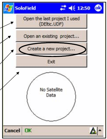
- Create New Project — Name it something that you will recognize later
- Hit OK — The Solo Forest Settings window will then appear

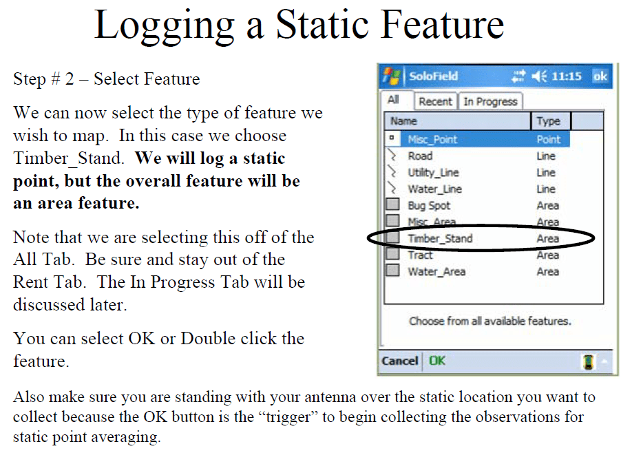
Step 2, select Generic Point or any other Point feature type