Census’ Batch Geocoder: https://geocoding.geo.census.gov/geocoder/geographies/addressbatch?form
Census’ Batch Geocoder documentation: https://www2.census.gov/geo/pdfs/maps-data/data/FAQ_for_Census_Bureau_Public_Geocoder.pdf
Association of Consulting Foresters member list: https://www.acf-foresters.org/ACFWeb/Directory/ACFWeb/Find_a_Forester/Directory.aspx
Submit a “Last name contains” = % query to return all records. Hit the “Select All” link to show all of the results on one page. Copy the results and paste them into NOTEPAD to strip all of the formatting and then copy/paste from NOTEPAD to Excel for formatting.
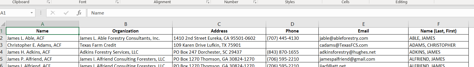
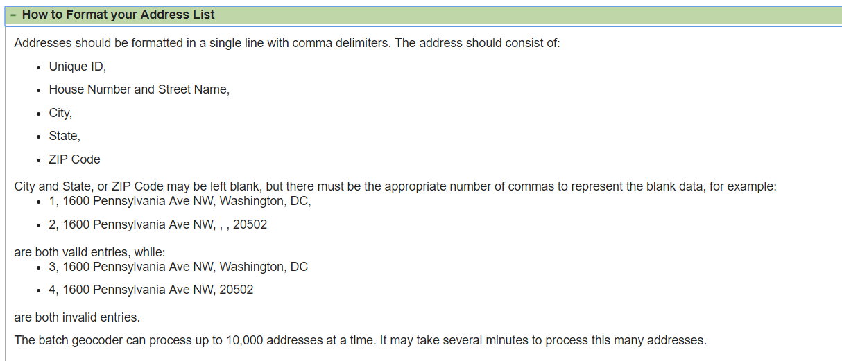
- Reformat the address information to conform to the Census Batch Geocoder’s requirements (not what you see in the screenshot above).
- UniqueID, House Number and Street Name, City, State, Zip
- Ensure you maintain a valid Unique ID field
- Save the results out as a CSV
- Upload them to the Census Batch Geocoder web application
NOTE: See VBA Magic II for Excel VBA reference
The Census Batch Geocoder will estimate an XY location for the well-defined addresses and will output the results as a new CSV. Use the MAKE XY EVENT LAYER tool in ArcMap to plot your Lat/Lons. The Census Bureau uses the NAD1983 datum (NOT WGS84). Find this spatial reference in ArcMap: Geographic Coordinate Systems >> North America >> USA and territories >> NAD 1983.