Last semester, I tasked students with describing suitable habitat for four animals: wild turkey, timber rattlesnake, striped skunk, and the black bear. Your task this week in lab is to develop a model to highlight these ‘suitable’ areas for each of the critters. You will use the topological operators I talked about in previous classes. ALSO, instead of running each tool individually, you will create a spatial model to run the entire process. I think you will like the Spatial Modeler feature in ArcMap. You will submit your results to the lab 8 assignment folder by Sunday at midnight.
You will use the RCWData from last week (a couple links above this document in our ELC Lab section). Please re-download, don’t reuse a copy you might already have.
Specie-specific habitat suitability criteria
You will use the topological (and other) functions to generate a habitat suitability layer for each of these animals.
- Wild Turkey Habitat: in forested areas older than 20 years (and) within 50m of a stream
- Timber Rattlesnake: in (forested areas less than 20 years), they also like grassland/herbaceous, they like barren land and they like shrub/scrub. All of these areas must be outside a 1 mile buffer of all developed areas
- Striped Skunk: within 1000 meters of a river (or) within 1000m of open water (or) within 1000m of (cultivated crops larger than 20 acres or pasture/hay larger than 20 acres)
- Black Bear: within 10 miles of shrub/scrub (or) within 10 miles of cultivated crops
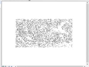
Wild Turkey:
CLEAR ALL SELECTED FEATURES IN ALL LAYERS. Dissolve Type: ALL when buffering.
(Deciduous, Evergreen, Mixed that are older than 20 years) that are within 50m of a stream
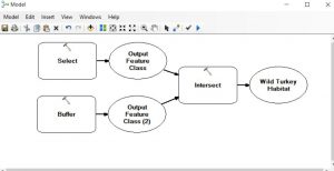
The result…
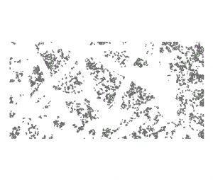
Timber Rattlesnake:
CLEAR ALL SELECTED FEATURES IN ALL LAYERS. Dissolve Type: ALL when buffering.
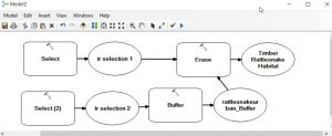
The result…
Striped Skunk:
CLEAR ALL SELECTED FEATURES IN ALL LAYERS. Dissolve Type: ALL when buffering.
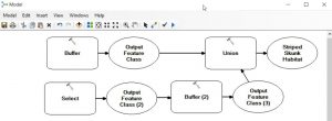
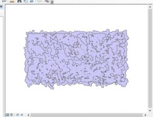
The result…
Black Bear:
CLEAR ALL SELECTED FEATURES IN ALL LAYERS. Dissolve Type: ALL when buffering.
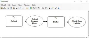
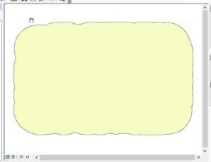
The result…
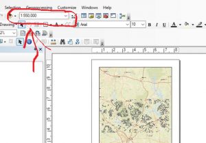
You’ve found the suitable habitats for the four species. Now, generate a spatial model to identify the common areas – places that satisfy criteria for Wild Turkey, Skunk, and Bear layers. Overlay your result on “Streets” basemap. Ensure your map layout is shown at a scale of 1:550000 (see screen shot below). Symbolize your common layer so the user can see the results at this scale.
Upload your JPEG map and a JPEG screen shot of your final model to the Lab 8 ELC Assignment folder.