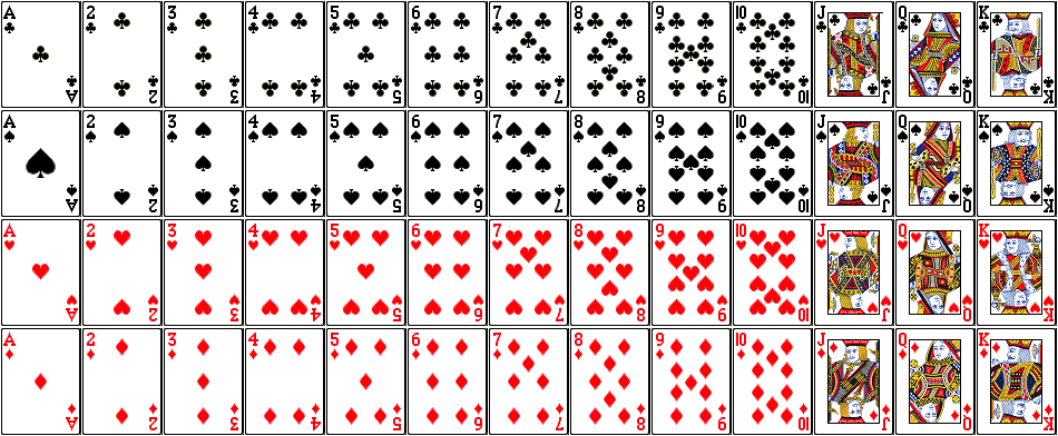
RECALL: ATTRIBUTE QUERY OPERATORS – AND, OR GIS Data Layer: LayerName: PlayingCards Description: There are 52 polygons; each polygon has one record in the attribute table Fields in the attribute table: SUITE: club, spade, heart, diamond COLOR: red, black FACECARD: yes, no VALUE: 1 – 13 (ace = 1, J […]
Fall2810
5 posts
RECALL: ATTRIBUTE QUERY OPERATORS – AND, OR GIS Data Layer: LayerName: PlayingCards Description: There are 52 polygons; each polygon has one record in the attribute table Fields in the attribute table: SUITE: club, spade, heart, diamond COLOR: red, black FACECARD: yes, no VALUE: 1 – 13 (ace = 1, […]
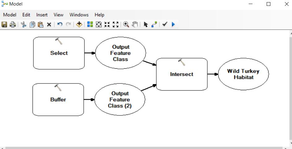
Last semester, I tasked students with describing suitable habitat for four animals: wild turkey, timber rattlesnake, striped skunk, and the black bear. Your task this week in lab is to develop a model to highlight these ‘suitable’ areas for each of the critters. You will use the topological operators I […]
Now that we’ve finished defining our habitat suitability criteria, I want you to implement it in the GIS. We are looking for the areas that are suitable for all four species. I want you to generate a map showing your findings. Submit it to the lab 7 assignment folder by […]
(http://www.gsd.harvard.edu/gis/manual/projections/) Things you should know about coordinate systems and ArcGIS: In ArcMap, the coordinate system consists of a projection, a datum, and a unit of measure. To make things easy for the user, ArcMap has many of them already defined in the software. Latitude/Longitude is considered an unprojected coordinate system […]