Warnell School of Forestry and Natural Resources FANR 3800 – Week 4 FANR3800 – Fall 2022 ESRI Lesson Plan – NOTE: The weekly ESRI.COM/TRAINING modules provide information relevant to the topics we review during lecture and hands-on practice using ArcPro to address the topics we talk about in class. […]
FANR3800
29 posts
Warnell School of Forestry and Natural Resources FANR 3800 – Week 3 FANR3800 – Fall 2022 ESRI Lesson Plan – NOTE: The weekly ESRI.COM/TRAINING modules provide information relevant to the topics we review during lecture and hands-on practice using ArcPro to address the topics we talk about in class. […]
Warnell School of Forestry and Natural Resources FANR 3800 – Week 2 FANR3800 – Fall 2022 ESRI Lesson Plan – NOTE: The weekly ESRI.COM/TRAINING modules provide information relevant to the topics we review during lecture and hands-on practice using ArcPro to address the topics we talk about in class. It […]
Warnell School of Forestry and Natural Resources FANR 3800 – Week 1 FANR3800 – Fall 2022 ESRI Lesson Plan – NOTE: The weekly ESRI.COM/TRAINING modules provide information relevant to the topics we review during lecture and hands-on practice using ArcPro to address the topics we talk about in class. It […]
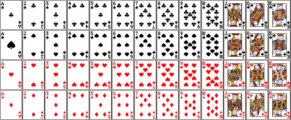
RECALL: ATTRIBUTE QUERY OPERATORS – AND, OR GIS Data Layer: LayerName: PlayingCards Description: There are 52 polygons; each polygon has one record in the attribute table Fields in the attribute table: SUITE: club, spade, heart, diamond COLOR: red, black FACECARD: yes, no VALUE: 1 – 13 (ace = 1, J […]
RECALL: ATTRIBUTE QUERY OPERATORS – AND, OR GIS Data Layer: LayerName: PlayingCards Description: There are 52 polygons; each polygon has one record in the attribute table Fields in the attribute table: SUITE: club, spade, heart, diamond COLOR: red, black FACECARD: yes, no VALUE: 1 – 13 (ace = 1, […]
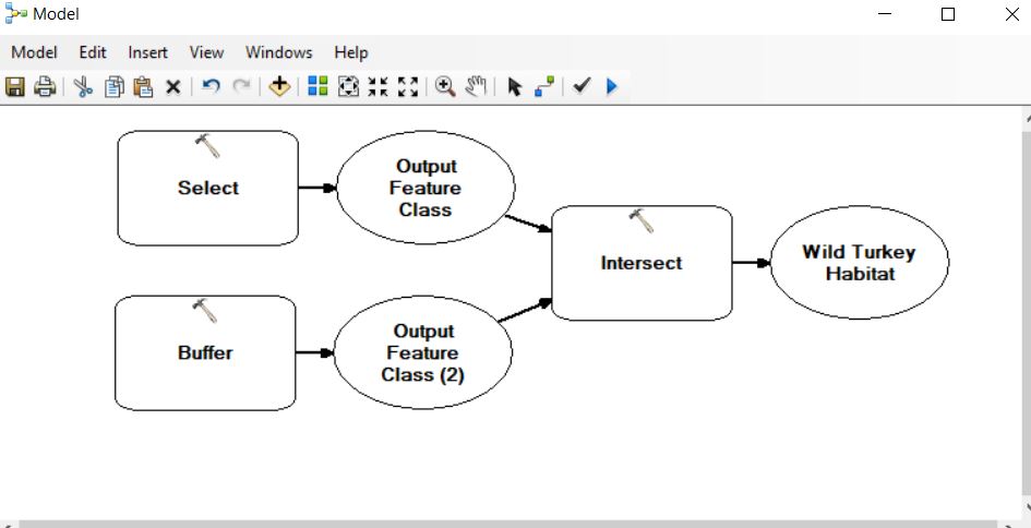
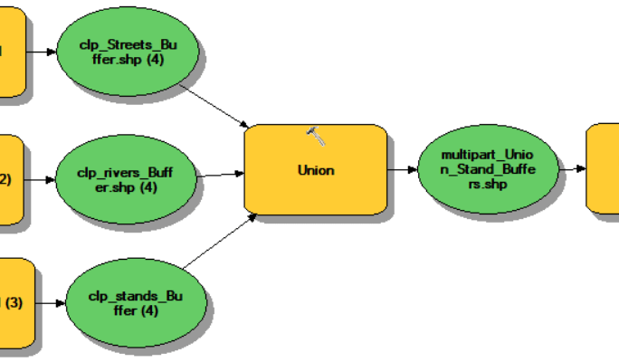
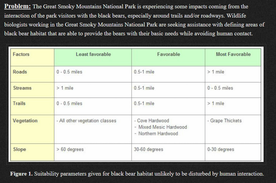
Last semester, I tasked students with describing suitable habitat for four animals: wild turkey, timber rattlesnake, striped skunk, and the black bear. Your task this week in lab is to develop a model to highlight these ‘suitable’ areas for each of the critters. You will use the topological operators I […]
Use the RCWData linked from the Lab section of our ELC page. I fixed the original shapefiles by exporting them to a file geodatabase. Attribute table information: baac: basal area per acre (ft2) cuft: cubic foot volume per acre (ft3) age2018: December 31, 2018 age (For this exercise, assume you […]
Raster Analysis (Bolstad pages 444 – 474) Consider the following management need. How would you approach this analysis? LOCAL FUNCTIONS: Processes the raster surface cell-by-cell Perform Map Algebra with Raster Calculator and/or the Spatial Analyst tools found in the ArcToolbox You can apply mathematical functions to individual or multiple layers […]

This week’s lab deliverable: Upload video topics 20, 21, 22, 23, 24, 25 and 26 to this week’s ELC lab assignment dropbox. I suggest you re-read the ArcGIS Video Tasklist instructions before you proceed (http://142.93.66.153/2018/07/12/fanr3800_videotasklist/). If you adhere to the recording guidelines, you can submit the videos to the FinalExamVideos […]