OCONEE FOREST PARK (Lake Herrick): DATA DOWNLOAD LINK
Here is the scenario: You have been asked to compile preliminary data for the Oconee Forest Park for an upcoming project. In the download above, you are provided three datasets:
- Lake_Herrick_Depths.csv: Lake depths captured with a Lowrance fish finder. XY coordinates exported using Lat/Long, WGS1984, decimal degrees
- OFP_Features.txt: Points of interest. XY coordinates stored in Lat/Long, WGS1984, DMS
- OFP_TrailIntersections.txt: Points within the forest where trails intersect. XY coordinates stored in UTM/NAD 1983/Zone 17N/Meters
Your task is to prepare these data for further analysis. Your map should look something like this when you are finished–> 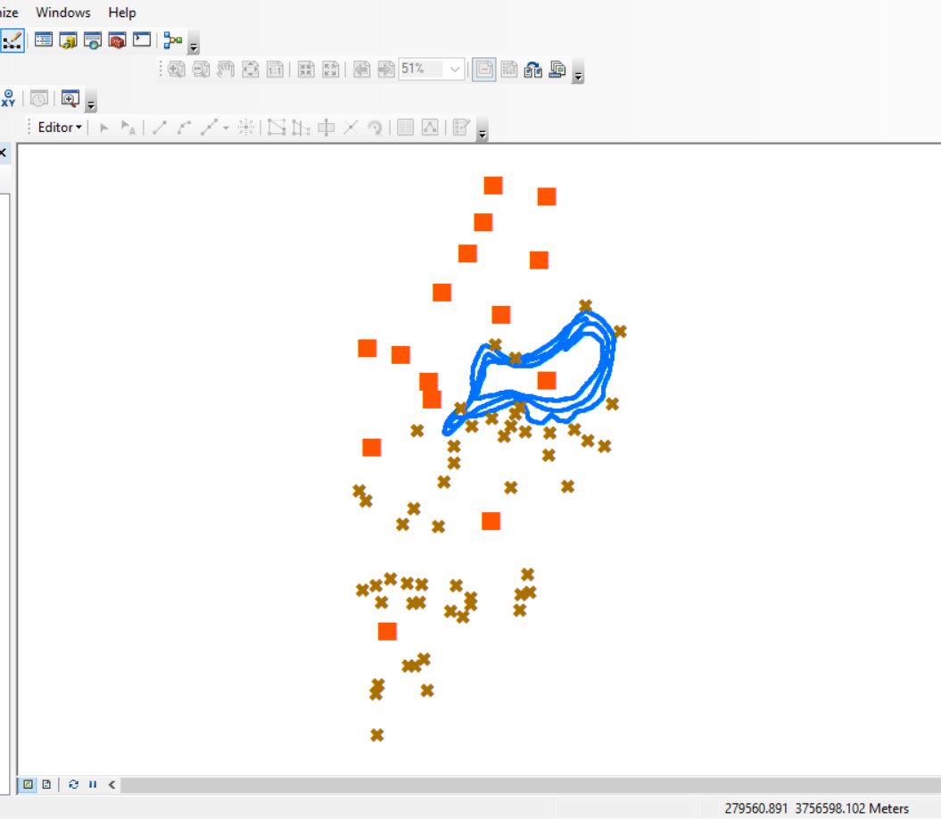
NOTICE THE TABLE FORMAT
- First row is the field names (no strange characters, no spaces, begin with A-Z, short, informative)
- Remaining rows are data
- Each column of data contain the same data types
- either all numeric or all text
- NAs can sometimes be troublesome
RECALL YOUR X’s & Y’s, NORTHINGS & EASTINGS, LATITUDES & LONGITUDES
Remember:
- when you move from one line of latitude to the next, you are moving up the Y-axis
- when you move from one line of longitude to the next, you are moving along the X-axis
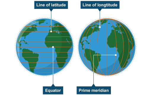
- there are 60 minutes in 1 degree and 3600 seconds in 1 degree; you must convert DMS to DD before you can plot the data in ArcMap
- UTM “northing” values are the Y-variable, and “easting” values are the X-variable
ARCMAP WORKFLOW
- Create your working directory
- Start ArcMap
- and set the Data View > Coordinate System to UTM/NAD1983/Zone17N
- save your project to your working directory
- create a new file geodatabase in your working directory
- Use Excel or R to convert DMS to DD (best to do it outside of ArcMap)
- Import your data files into the file geodatabase (TABLE TO TABLE tool in ArcMap)
- check the data mapping to ensure fields are imported as the proper type
- Plot the XY coordinates (MAKE XY EVENT LAYER tool in ArcMap)
- make certain that you specify the coordinate system that matches the XY’s you are importing
- Save the event themes out as feature classes in your file geodatabase.