RECALL: ATTRIBUTE QUERY OPERATORS – AND, OR
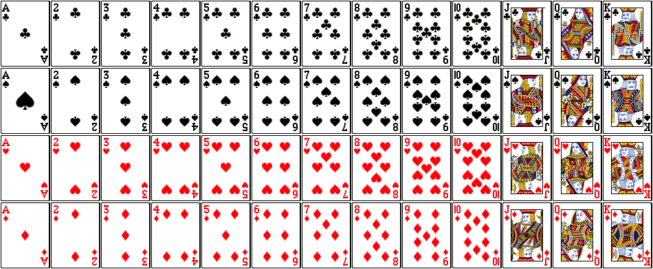
GIS Data Layer:
- LayerName: PlayingCards
- Description: There are 52 polygons; each polygon has one record in the attribute table
- Fields in the attribute table:
- SUITE: club, spade, heart, diamond
- COLOR: red, black
- FACECARD: yes, no
- VALUE: 1 – 13 (ace = 1, J = 11, Q = 12, K = 13)
SAMPLE QUERIES:
‘VALUE’ = 7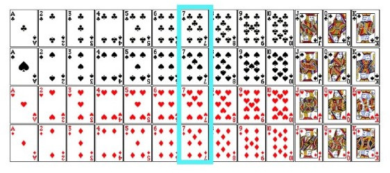
‘SUITE’ = “heart” 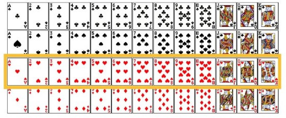
‘VALUE’ = 7 OR ‘SUITE’ = “heart” 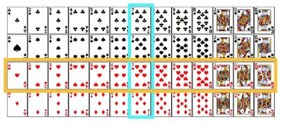
‘VALUE’ = 7 AND ‘SUITE’ = “heart” 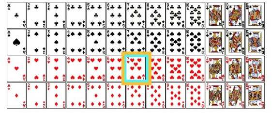
SELECT BY LOCATION
Now, instead of selecting by an attribute value, an Attribute Query, lets select cards based on a dice roll – specifically, where it lands.
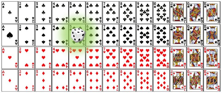
Consider the figure above where the die landed on the five-of-spades. Common questions addressed by SELECT BY LOCATION are:
- what card(s) did the dice land on (intersect)
- what card(s) are near the dice (within a distance)
Select by location (relationship = intersect)
The die intersects (passes over or lies across) the five-of-spades.
Select by location (relationship = within a distance)
The 4, 5, an 6 of hearts, diamonds, and spades are all within a (1 card) distance of the dice.
What if we had many dice? 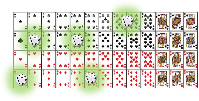
What if we had a landscape instead of cards and dice?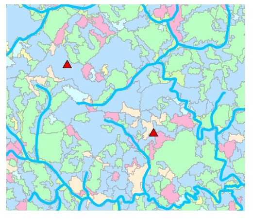
- What land cover types intersect the river?
- Which nests are within 500 meters of a river?
- Which nests are within 500 meters of a river and inside a hardwood stand?
- …
NOTE: The Select by Location command selects WHOLE polygons and addresses questions like “How many acres of each polygon have at least a part of its shape that falls within our analysis extent?” It does NOT answer questions like “How many acres are within a 50′ buffer of the river?”
ESRI select by location examples…