Part 107 Topics: Sectional Charts & Airspace
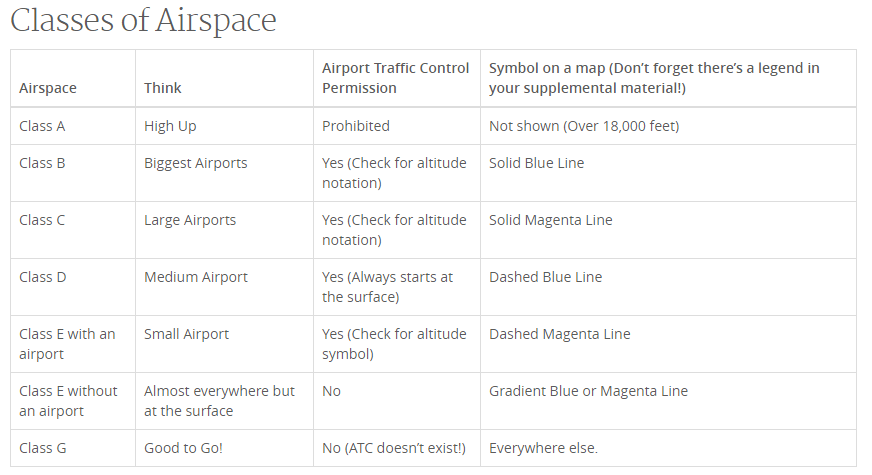 (source: https://3dr.com/faa/study-guides/airspace/)
Sectional Charts:
- Digital downloads: https://www.faa.gov/air_traffic/flight_info/aeronav/digital_products/vfr/
- are meant to only show a section of a flight region
- emphasize landmarks and features that would be used by manned aircraft for navigation
- include tall man-made structures, natural landmarks, roads, rivers, power lines, and railroad tracks
- depict airspace, airports, and reference points for manned aircraft
- remote pilot should use these to understand the environment around their operation and avoid other avaition activity
Obstructions:
These are man-made structures like radio and other communication towers and windmills
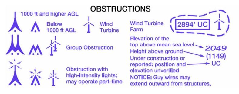
Full list of symbols (FAA VFR Symbols)
Links
3DR Airspace tutorial: http://3dairspace.org.uk/airspace.html
RemotePilot101 Airspace: https://www.youtube.com/watch?v=tX2_G9jzeuc
Ground School USA Airspace: https://www.youtube.com/watch?v=Jt-7phZ09j8
UAS Pilot Tutorial Airspace: https://www.youtube.com/watch?v=8AsfuNCs7oQ