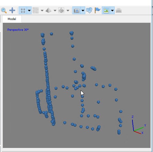
LINK TO PART I UAV-Mapper output (orthophoto, surface model, LAS) from the first part are stored in your working directory in a folder named “5_Products”. For this lab, however, use the point cloud I provide in the data you downloaded at the beginning of part 1: "clpSG_PointCloud_th001.las" which is saved […]
FANR5640/7640
50 posts
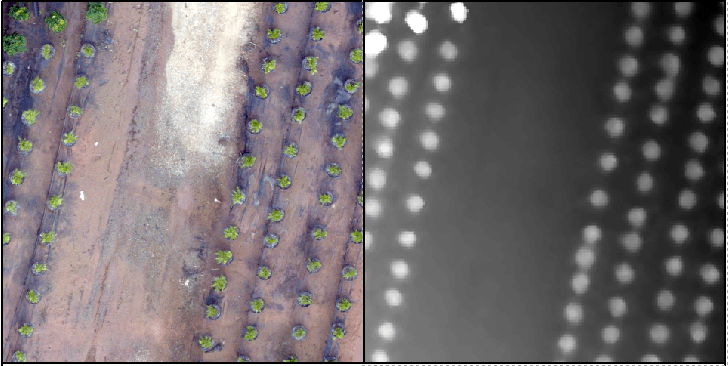
LINK TO PART II Recall the tree orchard site we’ve been looking at. This site is relatively flat with distinct (potted) objects. In this lab, I will attempt to lead you through an R-based analysis with the goal of segmenting the landscape (individual potted plants). Before you begin in R, […]
Lab 9 Data Link (clp_tls.laz). This is a large dataset, have patience!!! The “LAZ” file is a common point cloud file format storage type. You read a LAZ the same way you read a LAS – you process it using the same approach. See the LAND USE, CARBON & EMISSION […]
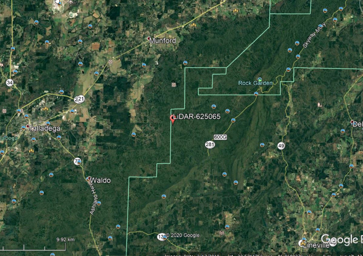
Lets continue with the Talladega National Forest LiDAR dataset… I have provided a link to a KML of the LiDAR panel 625065 extent. Give the site a look in Google Earth to get a better feel for the site (Figure 1). A stream in the northern part of this site […]
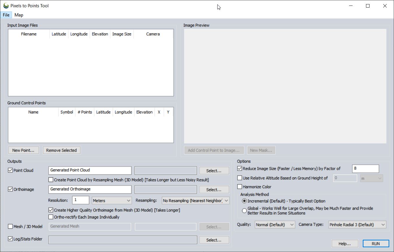
Pixels To Points Help In this lab, you will be processing drone data acquired on February 07, 2020 at the terraced section of the UGA Botanical Garden. The photos were captured with the DJI Phantom 4 Professional using the DJI Ground Station software running on an iPAD mini; the drone […]
Part 107 Regulations, Pilot Requirements (my crib notes from RemotePilot101/Lesson1: Rules and Regulations) Definitions: Remote Pilot In Command (PIC) – has the final authority of all sUAS operations; is not necessarily the person controlling the aircraft Visual Observer (VO) – person acting as a flight crew member to help ‘see and […]
Part 107 Regulations, Pilot Requirements Basic information and operator must know for flying under the small UAS rule (14 CFR part 107) FAA Commercial Operations Branch: Part 107 UAS Operations Pilot Requirements: Must be at least 16 years old Must pass an initial aeronautical knowledge test at an FAA-approved knowledge testing […]
Important links: FAA ‘Recreational Flyers: Fly Safe. Have Fun. (YouTube Webinar (0:00 – 11:45) FAA Recreational Flyers & Modeler Community-Based Organizations Background The model aircraft community is currently in a state of flux. Recreational flyers have been operating under the guidelines specified in Section 336 of the FAA Modernization and […]
Lab 11 RedEdge – Follow-up We’ve just flown a RedEdge mission out at Lake Herrick resulting in 275, 5-band multispectral images. Many of the images were acquired using a vertical flight pattern (5m AGL, 6m AGL, …, 200m AGL). The raw imagery has been converted to percent reflectance (DN […]
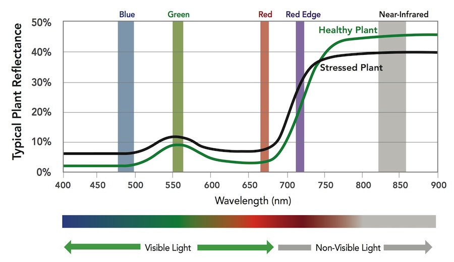
The MicaSense RedEdge-M a specialized sensor capable of recording reflected energy in the visible blue, green and red wavelengths as well as the non-visible red edge and near-infrared portions of the electromagnetic spectrum. Typical response of healthy plants, when compared to stressed plants, is lower in the visible […]