LINK TO PART I UAV-Mapper output (orthophoto, surface model, LAS) from the first part are stored in your working directory in a folder named “5_Products”. For this lab, however, use the point cloud I provide in the data you downloaded at the beginning of part 1: "clpSG_PointCloud_th001.las" which is saved […]
FANR5640/7640
36 posts
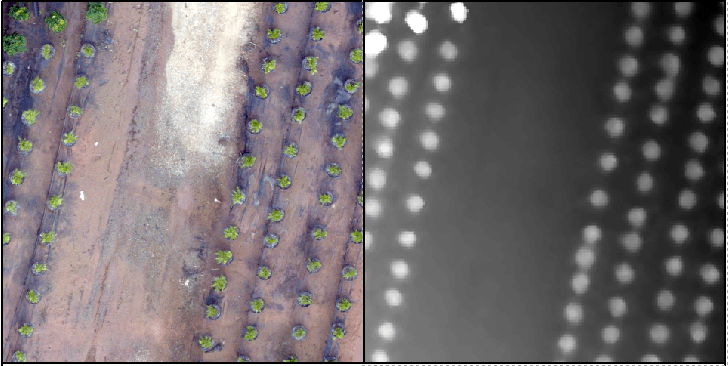
LINK TO PART II Recall the tree orchard site we’ve been looking at. This site is relatively flat with distinct (potted) objects. In this lab, I will attempt to lead you through an R-based analysis with the goal of segmenting the landscape (individual potted plants). Before you begin in R, […]
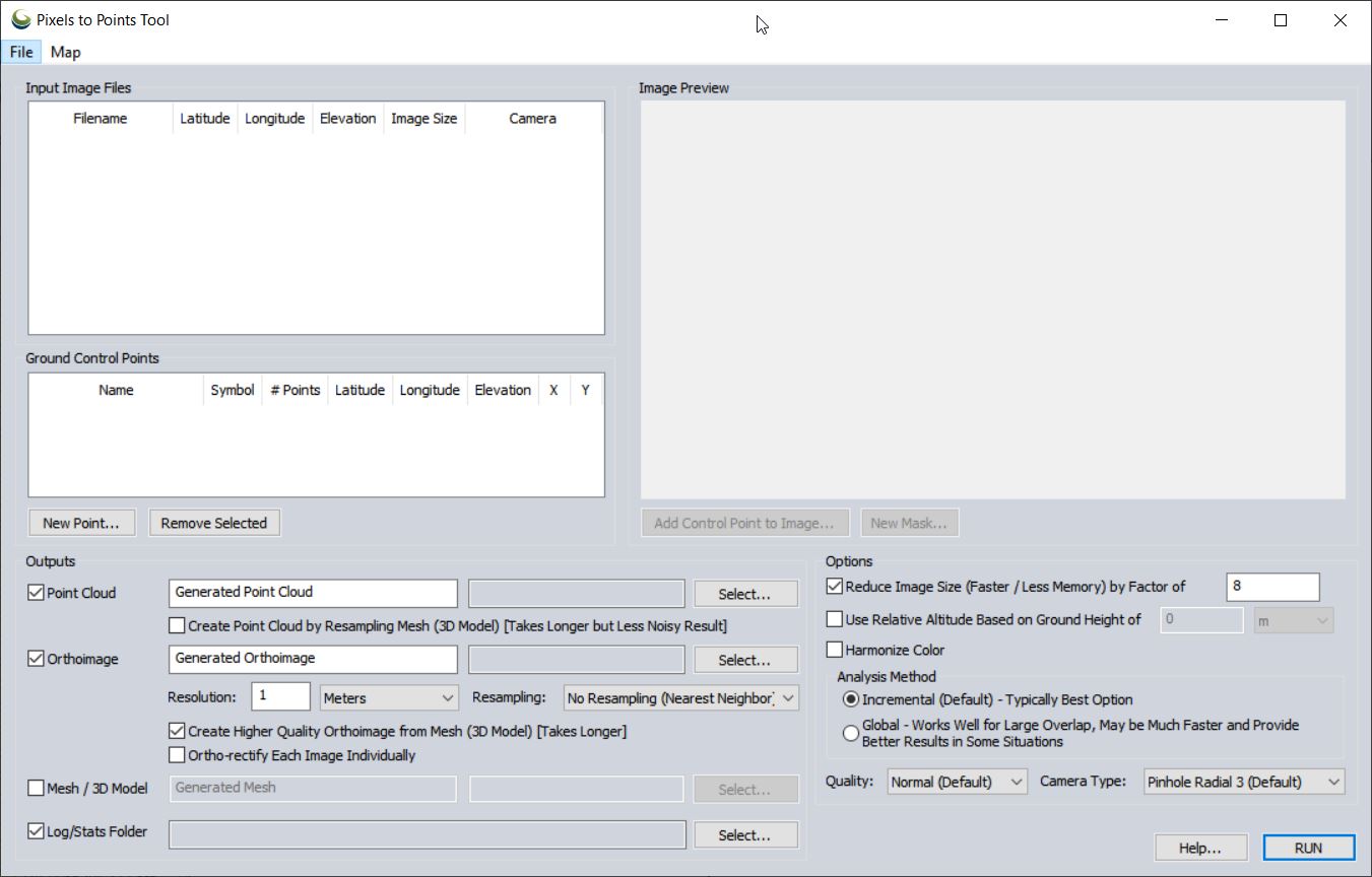
Pixels To Points Help In this lab, you will be processing drone data acquired on February 07, 2020 at the terraced section of the UGA Botanical Garden. The photos were captured with the DJI Phantom 4 Professional using the DJI Ground Station software running on an iPAD mini; the drone […]
Part 107 Regulations, Pilot Requirements (my crib notes from RemotePilot101/Lesson1: Rules and Regulations) Definitions: Remote Pilot In Command (PIC) – has the final authority of all sUAS operations; is not necessarily the person controlling the aircraft Visual Observer (VO) – person acting as a flight crew member to help ‘see and […]
Part 107 Regulations, Pilot Requirements Basic information and operator must know for flying under the small UAS rule (14 CFR part 107) FAA Commercial Operations Branch: Part 107 UAS Operations Pilot Requirements: Must be at least 16 years old Must pass an initial aeronautical knowledge test at an FAA-approved knowledge testing […]
Important links: FAA ‘Recreational Flyers: Fly Safe. Have Fun. (YouTube Webinar (0:00 – 11:45) FAA Recreational Flyers & Modeler Community-Based Organizations Background The model aircraft community is currently in a state of flux. Recreational flyers have been operating under the guidelines specified in Section 336 of the FAA Modernization and […]
Pixels To Points Help In this lab, you will be processing drone data acquired on February 07, 2020 at the terraced section of the UGA Botanical Garden. The photos were captured with the DJI Phantom 4 Professional using the DJI Ground Station software running on an iPAD mini; the drone […]
Download Lab Data Files Here 3-dimensional surface model from iPhone 6 video (Autodesk ReCap Pro 2018) In this lab, we will take a look at a ground-based approach of generating a 3 dimensional surface model. First we will consider the Warnell wood pile example. However neat you think this output may be, […]
Photo Info CSV I have over three years of drone photos stored on my computer. Unfortunately, I have not kept track of when/where/why I have flown. I do, however, have only a handful of directories in which I have saved these photos. I need to search specific directories on […]
FORS 5640/7640 Final Exam When: May 2, 2018, from 12 – 3 (if you have a conflict, please let me know as soon as possible) Where: In the GIS Lab Format: Closed book/Closed note; multiple choice Don’t forget upload your Remote Pilot 101 Quiz 1 – 9 […]