Skip to content
Download NAIP orthophotos
- NRCS Geospatial Data Gateway (https://datagateway.nrcs.usda.gov/)
- Follow the “Direct NAIP Download” link (right-hand side of the page under the ‘I Want To’ heading)
- Follow the “National Ag. Imagery Program County Mosaic” link to expose the NRCS NAIP repository (top link on the page)
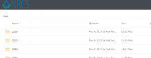
- The NAIP imagery is now stored in a Year/State/County structure. The most recent Georgia imagery was acquired in 2019
- The file naming convention is …_<State Abbreviation><County FIPS>_<Year>_…zip
- Example:
- List of County FIPS codes (HERE)
- Example for Georgia
- Drill down to YEAR > STATE >
- “ga_c”: color-infrared orthophotos
- “ga_n”: natural color orthophotos
- Oconee county, GA FIPS code is 219, so
- Oconee county natural color ortho: ga_n > ortho_1-1_hn_s_ga219_1.zip
- Oconee county color-infrared ortho: ga_c > ortho_1-1_hc_s_ga219_1.zip
- Copy the download to your working directory.
- These files are compressed, so you need to uncompress them to your working directory before you load them to your project.