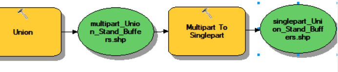
ArcGIS ModelBuilder (Geoprocessing >> ModelBuilder)
ESRI states that the ‘ModelBuilder is an application you use to create, edit, and manage models. Models are workflows that string together sequences of geoprocessing tools, feeding the output of one tool into another tool as input. ModelBuilder can also be thought of as a visual programming language for building workflows.’
ESRI Documentation:
Example:
Today, we will…
The goal here is to prepare conservation easement maps and area summaries for a holding in Greene county. Please round ALL numbers in your maps and summaries to the nearest tenth. Please only show vector data within the forest boundary (the ForestBoundary layer). Our client requested the following maps:
- Aerial map with the property boundary overlaying the most recent aerial and with roads visible and labeled.
- Cover type map showing the information in the Stands data layer (no digitizing required, just symbolize the existing stand polygons)
- symbolize the stand polygons by the different cover types (pine, hardwood, and mixed types, ..)
- label the stands with acreage
- overlay roads and rivers
- Photopoints map (lat/long coordinates for each location are stored in CPlatlong text file). You need to create an Event Theme and then save it out as a new layer.
- load the table
- right-click on table > Display as XY
- right-click on Event Theme (the new point layer showing) > Data > Export Data (this saves your event theme as a new shapefile)
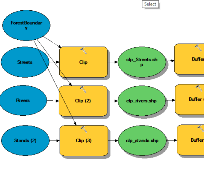
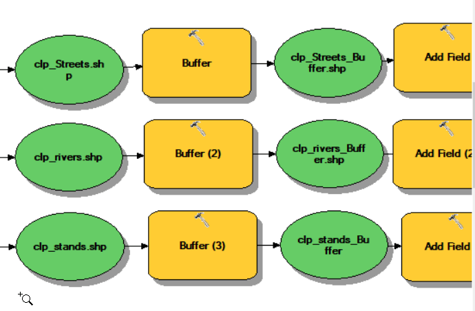
- Riparian buffer map showing
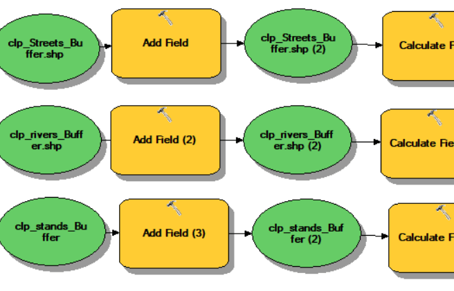
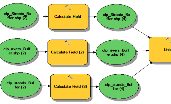
- buffers of 200′ around all features in the Rivers data layer and 200′ around each “Lake/Pond”, “Reservoir”, and “Stream/River” in the Lakes data layer
- show only the parts of your combined buffers that only fall within the ForestBoundary layer
BUFFER THEN CLIP; BUFFER THEN CLIP
- Conservation easement map with the following classifications (you have to generate this information yourself):
- “Special Natural Areas” (SNA): all hardwoods and all areas within the riparian buffer from #4
- “Agriculture Envelope” (AE):
– all areas not in SNA
– pine stands with an age of less than 6
– pine stands older than age 5 with a cuft volume per acre (cuft) of less than 500
– mixed stands type whose age is less than 21 years - “Forest Envelope” (FE): the remaining pine and mixed stand areas
- Upload to ELC assignment folder ‘Conservation Easement Maps’:
- A map showing the Photo Points (from #3) overlaying the map from #1. Label the Photo Points by PointID.
- Your map from #5
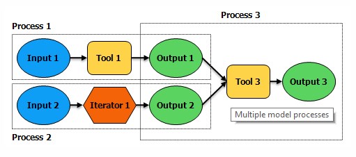
A closer look at #5

Process 1:
Process 2:
Process 3:
Process 4:
Process 5:
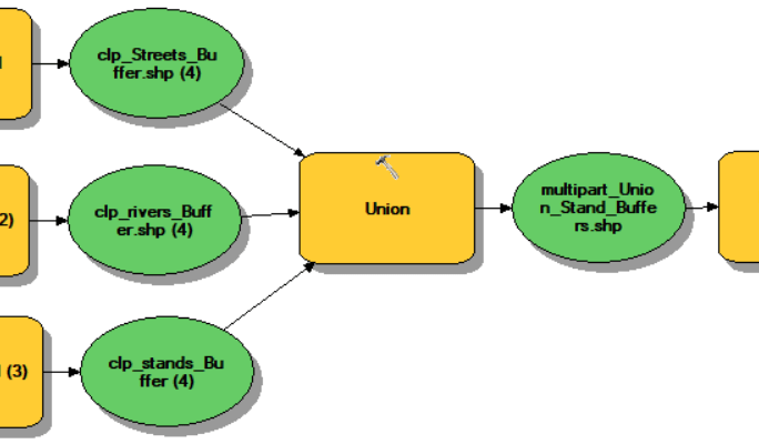
Process 6: