Forest Inventory and Analysis Program (FIA) Background: The Forest Inventory and Analysis (FIA) Program of the U.S. Forest Service provides the information needed to assess America's forests. As the Nation's continuous forest census, our program projects how forests are likely to appear 10 to 50 years from now. This enables […]
FORS7690
40 posts
.. .. What is FIA? https://www.fia.fs.fed.us/library/fact-sheets/overview/What_is_FIA_FS_2018_update.pdf The Enhanced Forest Inventory and Analysis Program – National Sampling Design and Estimation Procedures. This is the document you should reference when talking about the FIA. (http://www.treesearch.fs.fed.us/pubs/20371) Executive Summary: PDF page 9 1998 Farm Bill required: PDF page 14 Phase 1: PDF page 22 […]

Data are the facts or details from which information is derived Throughout this course, know that we are combining data on the basis of location and individual attributes to form actionable information… Anatomy of a mapping project You receive a request from a client who is planning for upcoming harvests. They need the following: Total […]
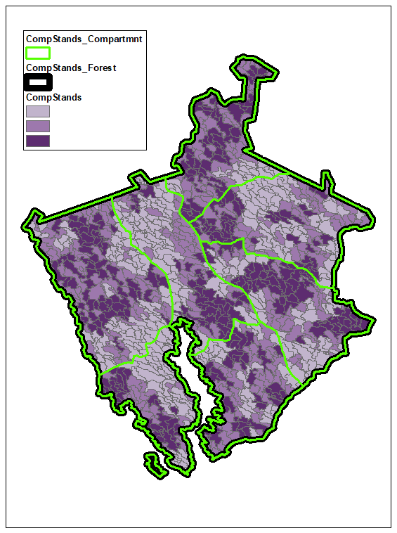
Sumter County Cruise Data Georgia GIS Clearinghouse Historical Imagery https://apps.itos.uga.edu/gsdi_rasterportal/ State: https://apps.itos.uga.edu/gsdi_rasterportal/resources/WMTSCapabilities_Statewide.xml Regional: https://apps.itos.uga.edu/gsdi_rasterportal/resources/WMTSCapabilities_Regional.xml County: https://apps.itos.uga.edu/gsdi_rasterportal/resources/WMTSCapabilities_County.xml Add a WMTS service to your ArcMap project: Open the Catalog window Scroll down and expand the GIS SERVERS selection Double-click ADD WMTS SERVER Paste the WMTS path into URL and hit GET LAYERS Expand the […]
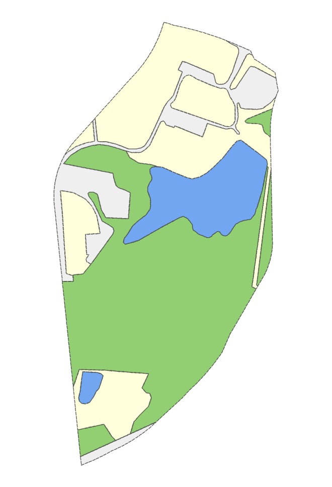
Georeferencing practice (Oconee Forest Park) OCFP SAMPLE DATA Set up your ArcMap project Load your georeferenced source image (NAIP2015_Source.jpg) Ensure your data frame coordinate system matches the NAIP (UTM17/NAD83/Zone17N…) Load your ungeoreferenced target image this layer is not georeferenced, you will not see it when it loads Save the project to your workspace Locate possible ground […]
Part I of your course notebook is due October 19 by midnight. Upload your work to the How-To Notebook Part I ELC assignment dropbox. I might move a topic to Part II if we don’t cover it before the document is due. I will announce any changes during […]
Georgia Conservation Tax Credit Program (GA DNR) Georgia Land Conservation Program (https://glcp.georgia.gov/) Conservation Easements (https://glcp.georgia.gov/conservation-easements) Georgia Conservation Tax Credit (https://glcp.georgia.gov/georgia-conservation-tax-credit) Conservation Easements A conservation easement, a voluntary legal agreement between a landowner and an easement holder, allows the landowner to impose permanent restrictions on the way the property is used. […]
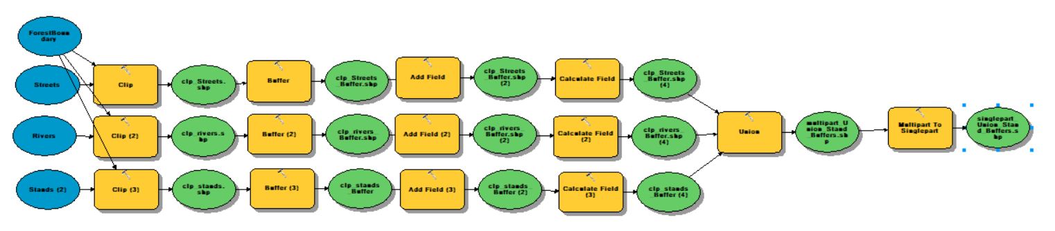
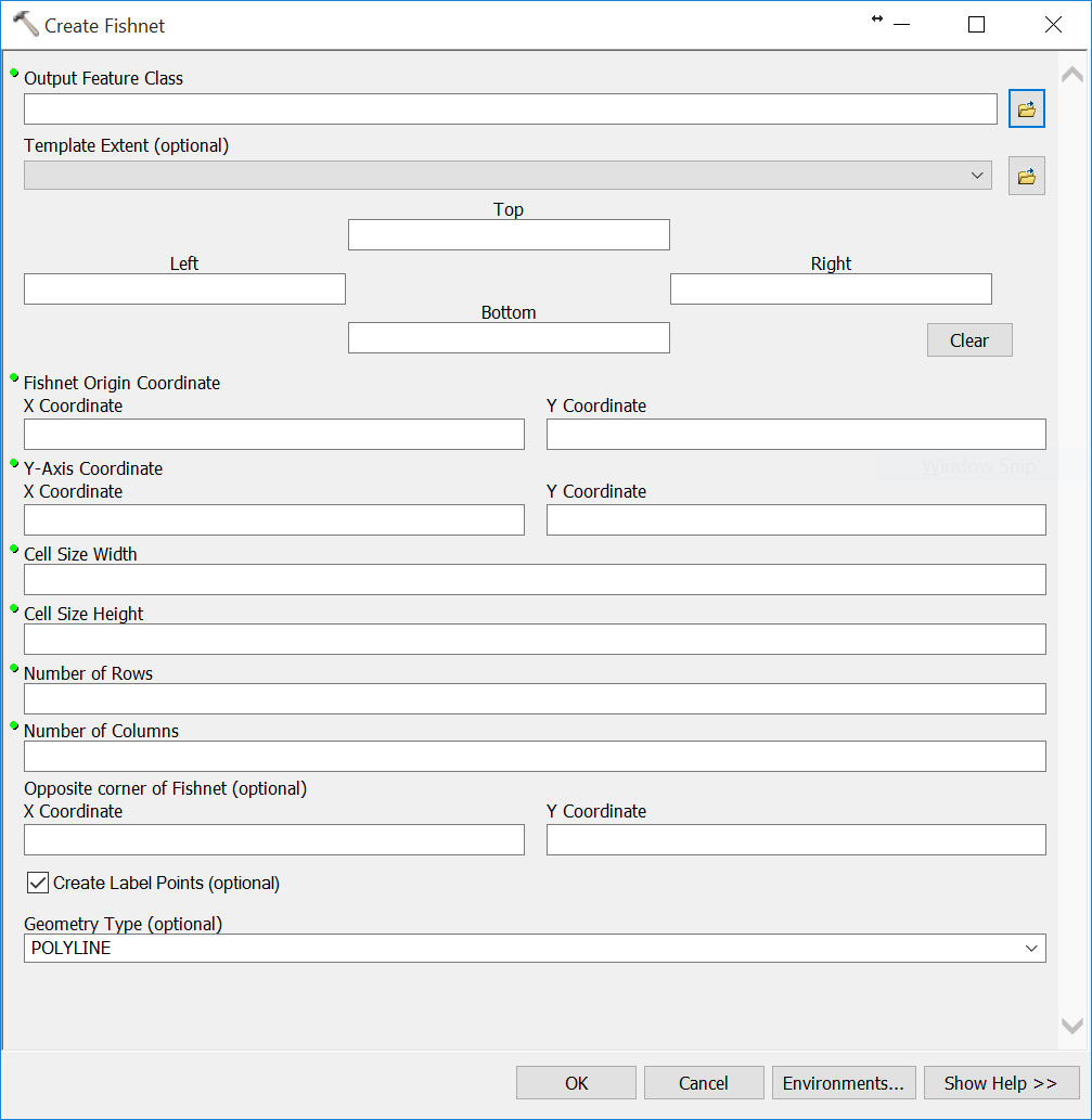
ArcGIS ModelBuilder (Geoprocessing >> ModelBuilder) ESRI states that the ‘ModelBuilder is an application you use to create, edit, and manage models. Models are workflows that string together sequences of geoprocessing tools, feeding the output of one tool into another tool as input. ModelBuilder can also be thought of as a […]
Sample Data Here Overlay Analysis We have already reviewed one overlay (selection) analysis tool – Select By Location. Recall, with this method, you select whole records in one layer that are spatially related in some manner (intersects, within a distance…, center is within…, etc) to another layer (Select By Location). This […]
Data Driven Pages (MapBooks) Exercise Data Here+ EXERCISE DATA HERE #2 (USE THIS ONE) ESRI’s What are Data Driven Pages? Data Driven Pages allow you to quickly and easily create a series of layout pages from a single map document. A feature layer, or index layer, divides the map into sections based […]