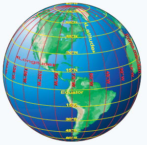
Latitude/Longitude Review
Please refer to the graphic below:
Latitude refers to the lines that run horizontally, parallel to the Equator. When one moves to the next line of latitude they travel in a north-south direction, they are traveling “up the ladder”. In Cartesian space such as our sectional maps, latitude is a measurement along the Y-axis. Latitude increases as you move north and decreases as you move south and is always positive here in the northern hemisphere. Latitude values range from 90° at the North Pole to -90° at the South Pole. When using DMS, the labels “N” and “S” are used to identify a point in the northern or southern hemisphere instead of a “-” (or the absence of a “-“).
- there are 60 seconds in one minute,
- there are 60 minutes in one degree, and with a little math we can show that
- there are 3,600 seconds in 1 degree.
When you report a coordinate pair using DMS, you must reduce the seconds and you must reduce the minutes. In other words, your second and minute measures should always be less than 60.
Gold Seal Flight Training’s Sectional Charts: Latitude and Longitude
Consider the sectional below, what is the lat/long coordinate of the Santa Catalina airport (to the nearest degree/minute)?
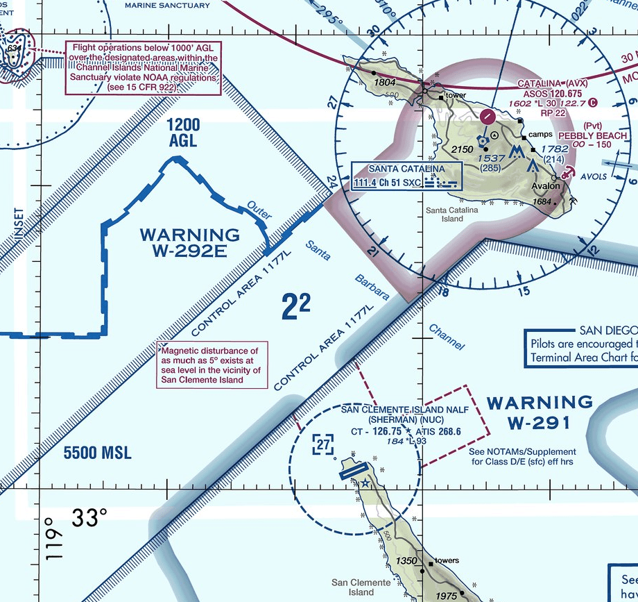
- locate the airport
- extend a line to the nearest labeled line of longitude
- add if you move west, subtract if you move east
- extend a line to the nearest labeled line of latitude
- add if you move north, subtract if you move south
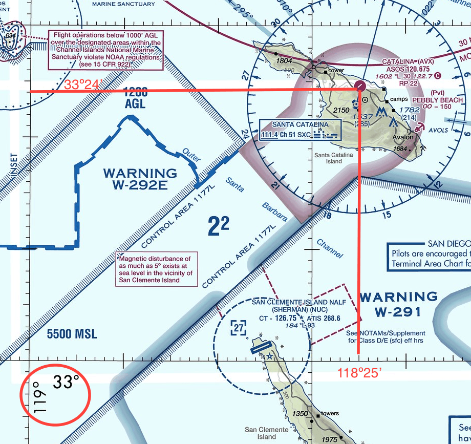
The answer is 33º24’N, 118º25’W
RP101, L6.6
Highly recommend reviewing the following: