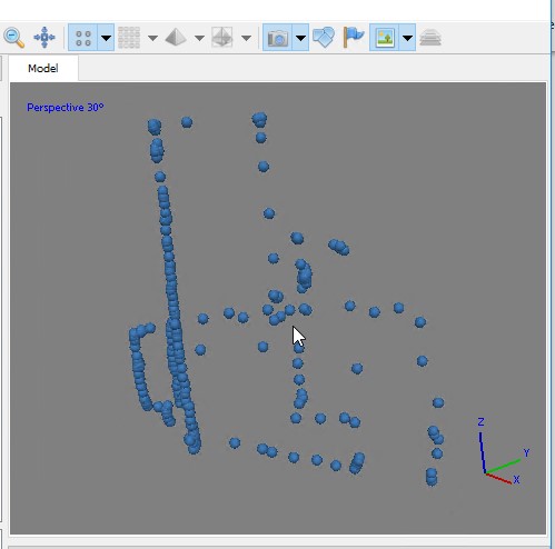
Lab 9 Data Link (clp_tls.laz). This is a large dataset, have patience!!! The “LAZ” file is a common point cloud file format storage type. You read a LAZ the same way you read a LAS – you process it using the same approach. See the LAND USE, CARBON & EMISSION […]
Spring2019
20 posts
Lab 11 RedEdge – Follow-up We’ve just flown a RedEdge mission out at Lake Herrick resulting in 275, 5-band multispectral images. Many of the images were acquired using a vertical flight pattern (5m AGL, 6m AGL, …, 200m AGL). The raw imagery has been converted to percent reflectance (DN […]
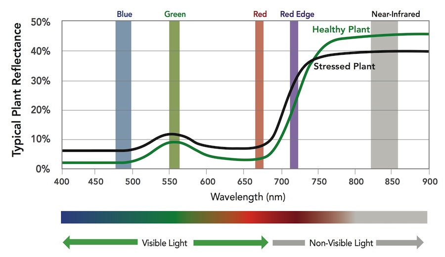
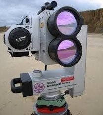
The MicaSense RedEdge-M a specialized sensor capable of recording reflected energy in the visible blue, green and red wavelengths as well as the non-visible red edge and near-infrared portions of the electromagnetic spectrum. Typical response of healthy plants, when compared to stressed plants, is lower in the visible […]
Notice to Airmen (NOTAMs): https://pilotweb.nas.faa.gov or https://skyvector.com/ flight planning purposes provides information to airmen which contains pertinent information to increase air safety applies to all pilots drone operators file a NOTAM only if you have a waiver that requires it purposes avoid temporarily restricted areas inform drone pilots […]
Lab deliverable is highlighted in Orange about half-way through the lab. Lab 10 is loosely based on the Agisoft Intermediate tutorial posted here: https://www.agisoft.com/index.php?id=35 Download photos from the March, 19, 2016 Botanical Garden flight (HERE). You will need to select all of the photos (tick box in upper […]
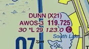
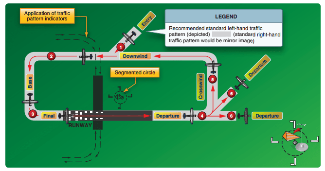
Still looking at sectionals… We will be working through this document this morning. Airport Terms: Uncontrolled airport: airport with no control tower CTAF: “Common Traffic Advisory Frequency”; the VHF frequency used for air-to-air communications AWOS: “Automated Weather Observing System”; an airport weather system that provides continuous, real time information and […]
[Newer version created on 2/2/2021] lidR v3.1.1 & rgdal v 1.5.21 Lab 9 Data Link (clp_tls.laz). This is a large dataset, have patience!!! The “LAZ” file is a common point cloud file format storage type. You read a LAZ the same way you read a LAS – you process […]
Operations near an airport Aguilar – Forza Business Strategies, Inc. Scenario: You present a scenario in which there are two adjacent properties owned by different persons. One has a state-permitted private-use heliport which is used 40 times per month. The other property is a vacant lot where construction has begun […]
Lab08 Data Download Lab 08: Coarse woody debris volume remaining after harvest [Excerpt from Brian Davis’ 2017 thesis,”REFINEMENT OF A DRONE-BASED METHOD FOR ESTIMATING COARSE WOODY DEBRIS AND BIOMASS RESIDUE FOLLOWING FOREST HARVEST”] "… Pine forests of the southern US are a major source of woody debris residues used for […]
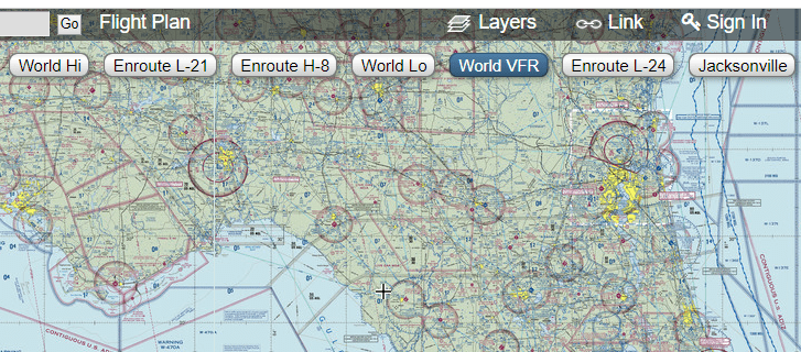
Sectionals: Special Use Areas (prohibited, restricted, warning military operation, alert) SOURCES: http://www.faraim.org/aim/aim-4-03-14-143.html http://www.faraim.org/aim/aim-4-03-14-144.html http://www.faraim.org/aim/aim-4-03-14-145.html http://www.faraim.org/aim/aim-4-03-14-146.html http://www.faraim.org/aim/aim-4-03-14-147.html and https://thinkaviation.net/prohibited-areas/ (www.skyvector.com)… NOTE: Pan/Zoom to your flight area (in this example, the Florida panhandle), then click the link in the upper-right to load the region’s sectional (see screenshots below). Click the “World VFR” […]