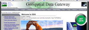
NRCS Geospatial Data Gateway (https://gdg.sc.egov.usda.gov/GDGHome.aspx)
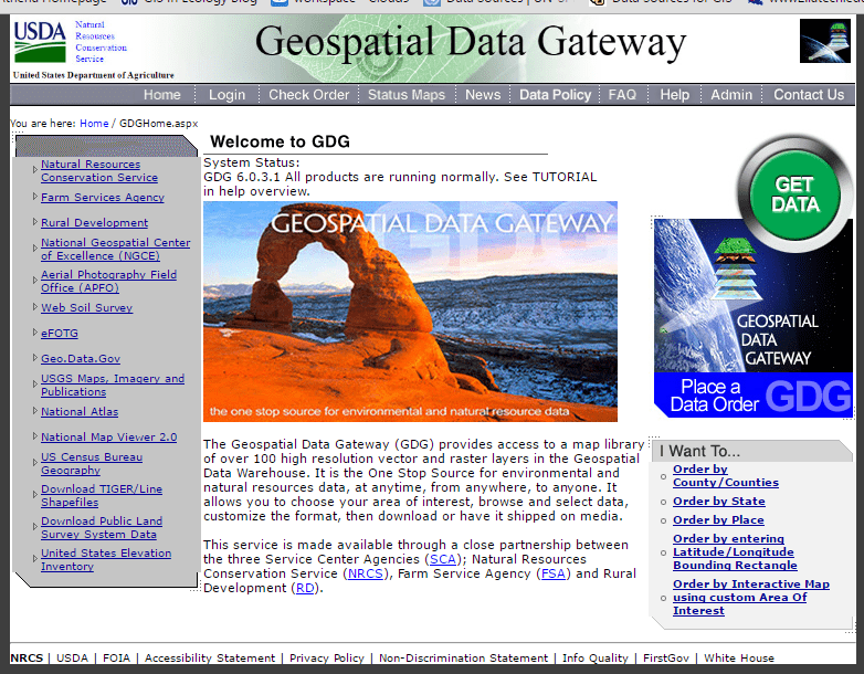
"The Geospatial Data Gateway (GDG) provides access to a map library of over 100 high resolution vector and raster layers in the Geospatial Data Warehouse. It is the One Stop Source for environmental and natural resources data, at anytime, from anywhere, to anyone. It allows you to choose your area of interest, browse and select data, customize the format, then download or have it shipped on media.
This service is made available through a close partnership between the three Service Center Agencies (SCA); Natural Resources Conservation Service (NRCS), Farm Service Agency (FSA) and Rural Development (RD)."
See this page for orthophoto download instructions (NRCS NAIP Download Document).
Use the instructions on this page to download non-orthophoto products (roads, rivers, soils, topo maps, etc).
The series of screenshots and notes should help you navigate the site. Good Luck!
- Goto https://gdg.sc.egov.usda.gov/GDGHome.aspx and click on the green ‘GET DATA’ button
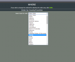
- Select the state you are interested in
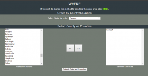
- Select the county (counties) you are interested in, hit the “>>” button, hit “Submit Selected Counties”
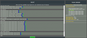
- You are then presented with a list of GIS layers available for download. If you are interested in watersheds, check the box next to the 8, 10, or “12 Digit Watershed…” entry under Hydrologic Units. There is a lot to choose from. You are limited to 2GB per download – the download size is shown in the right-hand window under Your Order. Hit “Continue” once you have selected the datasets you need.
- The next screen might ask about file format and projection. If prompted, select shapefile for the file format and the UTM entry for the projection. Hit “Continue”.
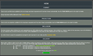
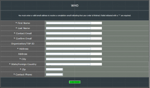
- Now, you need to fill in your contact information. You will be notified when your downloads are ready, so give a truthful email. Hit “Continue”.
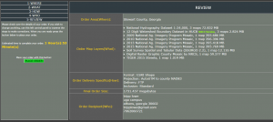
- You are then presented with a review of your order. If all looks well, hit the green “PLACE ORDER” button on the left-hand side of your screen.
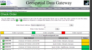
- You will receive an email when your order is ready. If you are impatient, go back to the main site and hit the “Check Order” button along the top row of buttons.
- Enter your email on the next screen and hit “Go” to review the status of your order. A yellow status means the order is still processing and green means your data is ready for download.
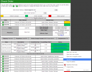
- Download the data by expanding your order, then right-click on one of the “Success (Download Now!)” links >> Save Link As… >> <navigate to your project directory>
The data you download from the NRCS Geospatial Data Gateway is compressed (zipped) and you must uncompress the files before you can load them into ArcGIS. Navigate to your project folder >> right-click on one of the compressed files you downloaded >> Extract All… !!!Make sure you extract the files to a suitable location. This means your file path should NOT contain any spaces or strange characters!!!
Also, be aware that the compressed soils data contains a second compressed file – a zipped file within a zipped file. You must uncompress the file you download and then uncompress the zipped file within.
Good Luck!
-Tripp