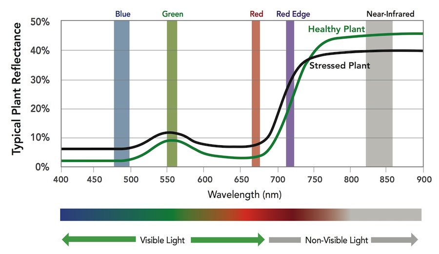
Drone Deploy – Understanding NDVI ENDVI: https://www.maxmax.com/endvi.htm Lawn care example: https://www.maxmax.com/lawn_care_2.htm Harris Geospatial VI list Normalized Difference Vegetation Index (NDVI) This index is a measure of healthy, green vegetation. The combination of its normalized difference formulation and use of the highest absorption and reflectance regions of chlorophyll make it robust over […]
Monthly Archives: April 2017
2 posts

OpenDroneMap (opendronemap.org) ODM on github Installation: The easiest way to get ODM up and running is to install through a Docker image (Instructions). Video showing how to spin up an Amazon AWS & ODM (here) My ODM install: Ubuntu 16.04 Server Cinnamon desktop environment Run ODM through docker Example ODM […]