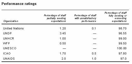
To start with, we will look at this data layer. I want to demonstrate why we might be concerned about distortion in our data due to the user’s choice of coordinate system. Have a little patience, I will release the lab data in a few minutes. Close this project when […]
Daily Archives: August 29, 2018
2 posts
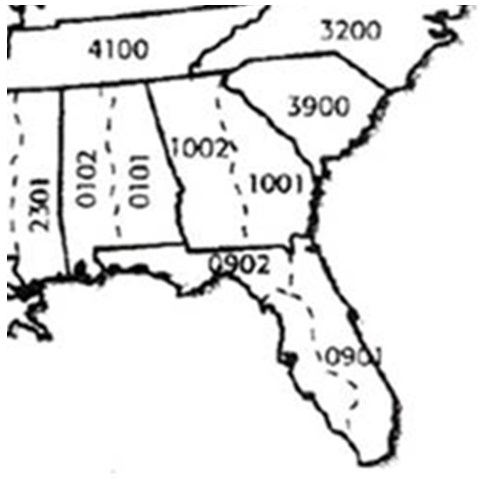
In practice Select a coordinate system with the least distortion for your project area When working across states or continents, the distortion (aka error) could be very large If you are unsure what CS to use, look to see what coordinate system the ‘experts’ use when working in the same […]