LINK TO PART I UAV-Mapper output (orthophoto, surface model, LAS) from the first part are stored in your working directory in a folder named “5_Products”. For this lab, however, use the point cloud I provide in the data you downloaded at the beginning of part 1: "clpSG_PointCloud_th001.las" which is saved […]
Spring2021
2 posts
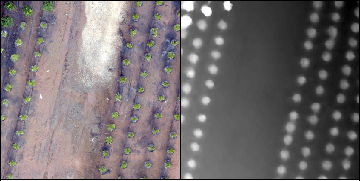
LINK TO PART II Recall the tree orchard site we’ve been looking at. This site is relatively flat with distinct (potted) objects. In this lab, I will attempt to lead you through an R-based analysis with the goal of segmenting the landscape (individual potted plants). Before you begin in R, […]