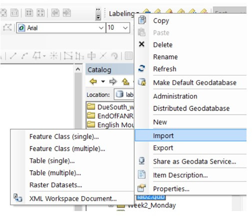
Background information (tables, file geodatabases, and shapefiles) In this lab, you will: create an event theme from a series of XY coordinate pairs stored in a data file, convert between shapefile and file geodatabase file formats, you will download a kml from qpublic, import it into arcmap, and then you will […]
Daily Archives: August 17, 2016
2 posts
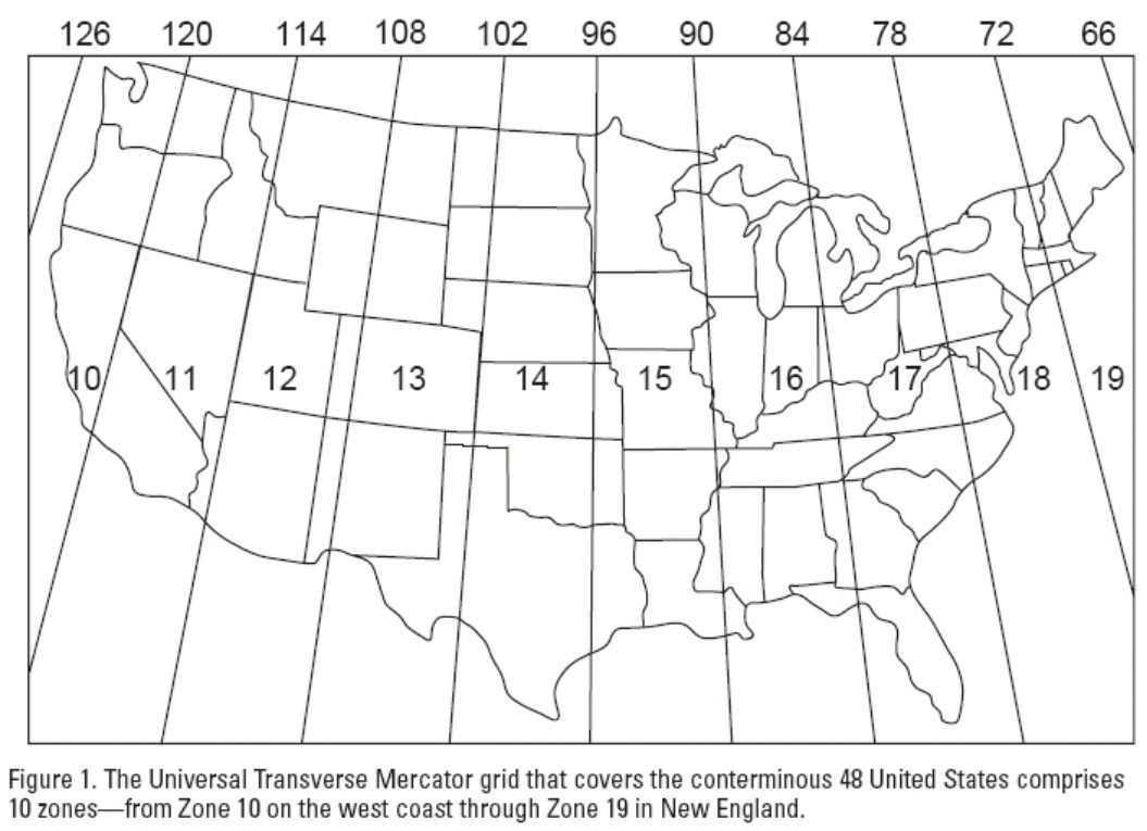
Somebody asked about UTM measurements south of the equator… UTM has a north and south zone, each are measurements from the equator… ESRI: What are map projections? The above links you to ESRI’s excellent explanation of map projections, coordinate systems, spatial references, and related ArcGIS tasks. You need to […]