
Georgia Conservation Tax Credit Program (GA DNR) Georgia Land Conservation Program (https://glcp.georgia.gov/) Conservation Easements (https://glcp.georgia.gov/conservation-easements) Georgia Conservation Tax Credit (https://glcp.georgia.gov/georgia-conservation-tax-credit) Conservation Easements A conservation easement, a voluntary legal agreement between a landowner and an easement holder, allows the landowner to impose permanent restrictions on the way the property is used. […]
Monthly Archives: October 2017
11 posts
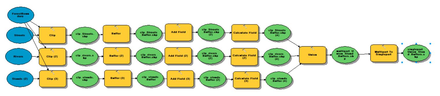
ArcGIS ModelBuilder (Geoprocessing >> ModelBuilder) ESRI states that the ‘ModelBuilder is an application you use to create, edit, and manage models. Models are workflows that string together sequences of geoprocessing tools, feeding the output of one tool into another tool as input. ModelBuilder can also be thought of as a […]
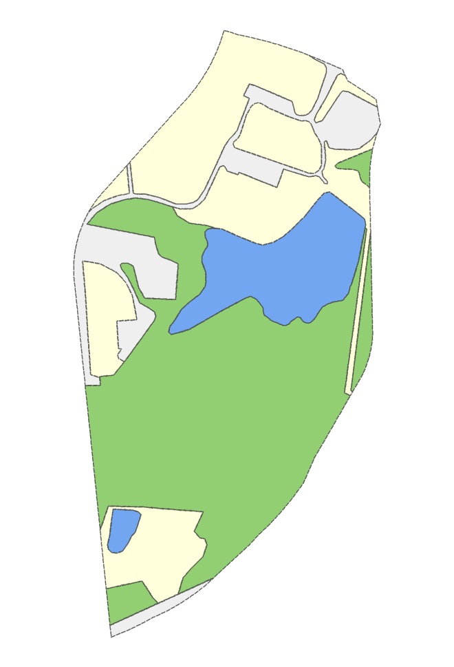
Sample Data Here Overlay Analysis We have already reviewed one overlay (selection) analysis tool – Select By Location. Recall, with this method, you select whole records in one layer that are spatially related in some manner (intersects, within a distance…, center is within…, etc) to another layer (Select By Location). This […]
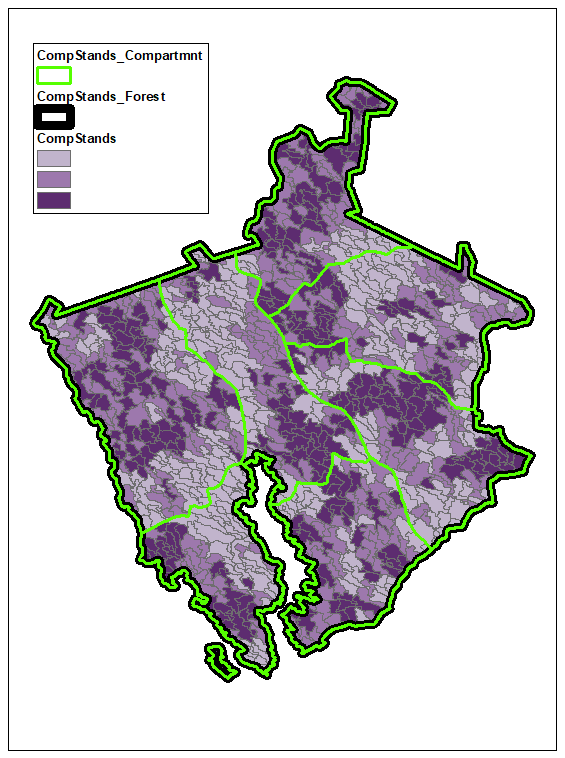
Data Driven Pages (MapBooks) Exercise Data Here+ EXERCISE DATA HERE #2 (USE THIS ONE) ESRI’s What are Data Driven Pages? Data Driven Pages allow you to quickly and easily create a series of layout pages from a single map document. A feature layer, or index layer, divides the map into sections based […]
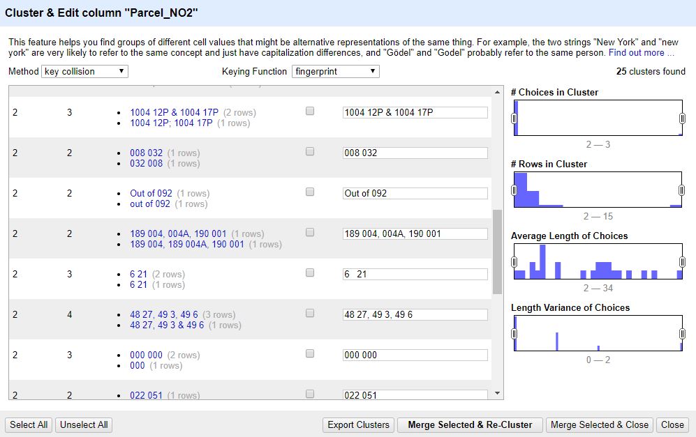
If you didn’t archive the OpenRefine 2.7 (Windows Kit) last Wednesday, redownload (OpenRefine Download) and extract it to your working directory. Start OpenRefine (double click the openrefine.exe) and let the browser install Java again. Once Java has installed, restart OpenRefine. We will be working with this dataset (Prop2010_gt100ac.txt). Save […]
The data I use today can be downloaded HERE Queries and Selections Attribute Query (ArcGIS Attribute Query Help): allows the user to select features in a layer based on the values stored in its attribute table. Select By Location (ArcGIS Select By Location Help): allows the user to select features based on […]
In today’s demonstration, I will walk you through the process of joining an Evalidator query result to a data layer in ArcMap. We will use the Evalidator reports and the 2015 Census county boundaries zip file (here). Copy the file to your E:\ drive and uncompress it. You’ll find the county […]
Useful EXCEL VBA Commands: Most of these commands work in EXCEL and ArcGIS Field Calculator. ESRI support has a nice description of these commands in the context of the Field Calculator here and some examples here. left: The Microsoft Excel LEFT function allows you to extract a substring from a string, […]
American FactFinder: (https://factfinder.census.gov/) NOTE: The subsections for each bulleted step below tell you how to perform the task. Visit AFF >> Advanced Search >> SHOW ME ALL Filter to Congressional District Click Geographies on left-hand side of screen Select “Congressional District” from the dialog dropdown Select “All Congressional Districts (115th Congress…)” […]
The Enhanced Forest Inventory and Analysis Program – National Sampling Design and Estimation Procedures (http://www.treesearch.fs.fed.us/pubs/20371) FIA standards: PDF page 24 (starting w/ last paragraph) Plot Layout: PDF page 39 Derivation of population estimates: PDF page 53 Sampling Error: PDF page 69 Used by FIA to reflect the accuracy of the […]