
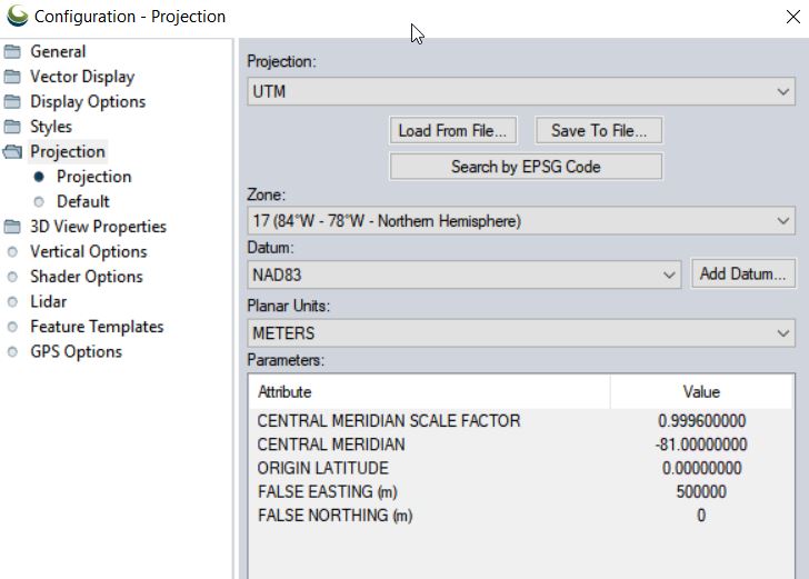
Monday, you stepped through a simple analysis in ArcMap. You created a normalized surface model (I called it the DZM in the lab document) by differencing the surface model (DSM) and the terrain model (DTM). The resulting raster layer contains cells whose values are 0 or near-zero. These cells represent […]
Monthly Archives: February 2019
4 posts
Pixels To Points Help In this lab, you will be processing drone data acquired on February 07, 2020 at the terraced section of the UGA Botanical Garden. The photos were captured with the DJI Phantom 4 Professional using the DJI Ground Station software running on an iPAD mini; the drone […]
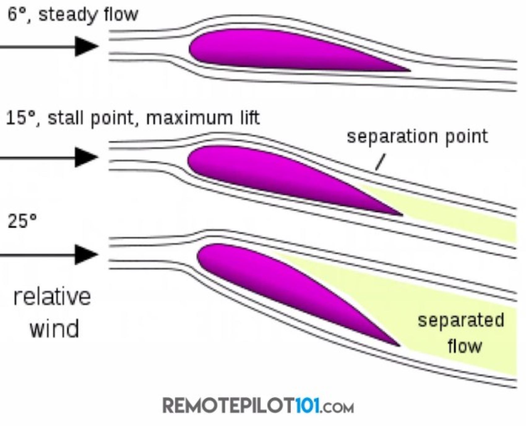
The Basic Physics of Drones Now, the effects of loading and weight on aircraft (sUAS) performance Flying an aircraft overweight is detrimental to its performance It is critical to adhere to the weight and balance limits specified by the manufacturer of your aircraft (you will see this document […]
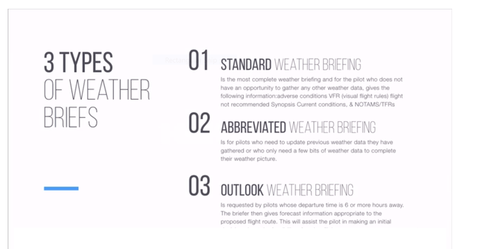
Weather Info, See: FAA Remote Pilot – Small Unmanned Aircraft Systems Study Guide (Chapter 3a & 3b) Drone U Part 107 Drone Certificate Study Guide (Section III, p83…) FAA UAS Test Study Guide by Kelsey Mason (see Weather Theory Stuff section) Weather notes… These are topics that will appear […]