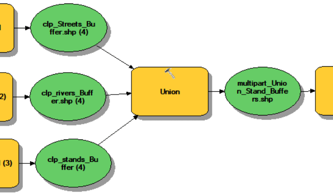
Use the RCWData linked from the Lab section of our ELC page. I fixed the original shapefiles by exporting them to a file geodatabase. Attribute table information: baac: basal area per acre (ft2) cuft: cubic foot volume per acre (ft3) age2018: December 31, 2018 age (For this exercise, assume you […]
Monthly Archives: February 2020
3 posts
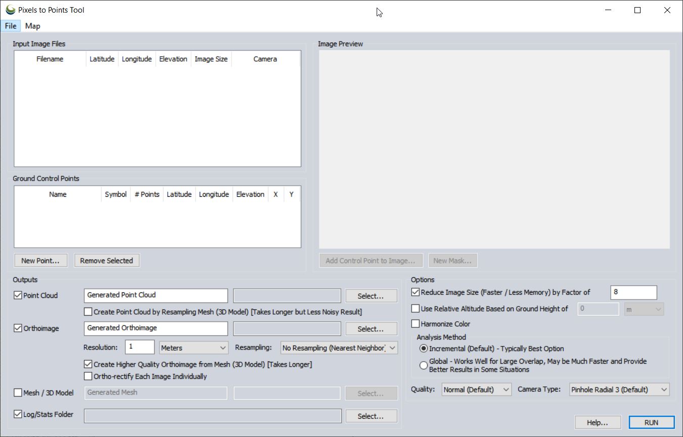
Pixels To Points Help In this lab, you will be processing drone data acquired on February 07, 2020 at the terraced section of the UGA Botanical Garden. The photos were captured with the DJI Phantom 4 Professional using the DJI Ground Station software running on an iPAD mini; the drone […]
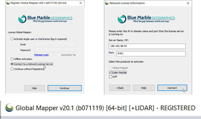
The following instructions step you through the process of connecting to the Warnell Global Mapper license server. If you are interested, you can install Global Mapper on your personal computer or lab machine, too. Download the installation files from the Global Mapper website (https://www.bluemarblegeo.com/products/global-mapper-download.php) and connect to the license server […]