
Assessment of timber harvests in Stewart County, GA Not many written instructions today. I plan to step you through a Landsat-based assessment of timber harvests in Stewart county, Georgia. Today, you will: Download multiple years of Landsat 8 and Sentinel 2 satellite imagery Generate NDVI layers for each Perform an automatic […]
Yearly Archives: 2016
23 posts
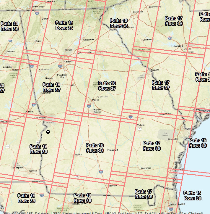
I went ahead and downloaded a couple Landsat images for us to work with just in case their site goes offline. Go ahead and download these and copy them over to this week’s working directory. Don’t worry about extracting them yet. Landsat 8 image and Landsat 7 image Landsat data […]
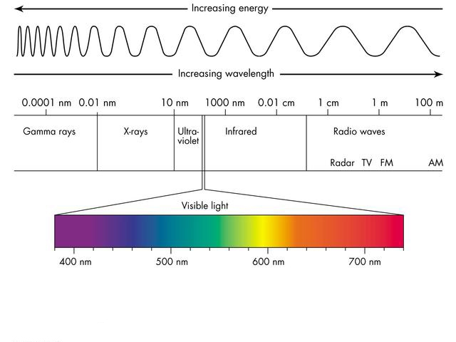
Short Intro to Satellite Remote Sensing Important terms and topics Electromagnetic spectrum DN v. Radiance v. Reflectance Active/Passive sensor Spatial resolution Spectral resolution Temporal resolution Spectral signature Electromagnetic Spectrum Digital Number (DN) v. Radiance v. Reflectance (Good Description Here) DN: The digital number is the generic term for pixel values […]
Normalizing data: the process of organizing data into tables in such a way that the results of using the database are always unambiguous as intended. Download this dataset and copy it to your C:\ drive workspace and uncompress it. Load the Buyer2010_gt25ac table to ArcMap. Save your ArcMap project to your C:\ drive […]
My original plan for today was to cover spatial selections; instead I will first briefly cover steps to take to normalize the street names ([STREET_NAM]) in the Prop2015 table. After this, we will move on to spatial selections. Problem: Recall we have 403,751 records in the Prop_2015 table. Our goal in […]
Anatomy of a property mapping project You receive a request from a client who is planning for upcoming harvests. They need the following: Total stand acreage Acreage of each land cover type The UTM zone 17N X & Y coordinates of the three proposed logging deck sites Maps showing the most […]
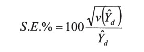
The Enhanced Forest Inventory and Analysis Program – National Sampling Design and Estimation Procedures (http://www.treesearch.fs.fed.us/pubs/20371) FIA standards: PDF page 24 (starting w/ last paragraph) Plot Layout: PDF page 39 Derivation of population estimates: PDF page 53 Sampling Error: PDF page 69 Used by FIA to reflect the accuracy of the […]
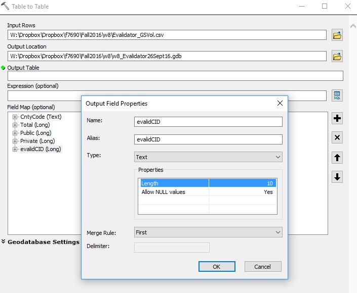
In today's demonstration, I will walk you through the process of joining an Evalidator query result to a data layer in ArcMap. We will use the Evalidator reports and the 2015 Census county boundaries in this zip file (here) . While the context of my example today may or may not […]
In today's lab, need to first answer two simple questions: 1) which Georiga 115th Congressional district has the most private timberland acreage and 2) how does the median real estate tax paid in this district compare to the other districts adjacent to it? In addition, answer the following: - The […]
American FactFinder: (https://factfinder.census.gov/) NOTE: The subsections for each bulleted step below tell you how to perform the task. Visit AFF >> Advanced Search >> SHOW ME ALL Filter to Congressional District Click Geographies on left-hand side of screen Select “Congressional District” from the dialog dropdown Select “All Congressional Districts (115th Congress…)” […]