
Things you need to know about coordinate systems and ArcGIS: In ArcMap, the coordinate system consists of a projection, a datum, and a unit of measure. To make things easy for the user, ArcMap has many of them already defined in the software. a. Latitude/Longitude is considered an unprojected or […]
Monthly Archives: August 2016
7 posts
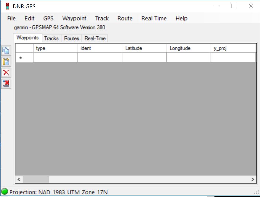
DNRGPS Application The DNRGPS application was built to transfer data between Garmin handheld GPS receivers and the computer. It can be downloaded from the Minnesota DNR ArcView Resources web page (http://www.dnr.state.mn.us/mis/gis/DNRGPS/DNRGPS.html). For our purposes, the DNRGPS for ArcMap 10.2 will do. This is a ‘green’ application so all you need […]
YouTube listing for Garmin GPSMAP 64 Garmin GPSMAP 64 GPS: Receiver Setup: Turn the receiver on. Press and hold the button for 2-3 seconds. The On/Off button is located on the upper right-hand side of the receiver. Buttons of importance today: ENTER – To select an option from a […]
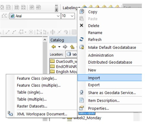
Background information (tables, file geodatabases, and shapefiles) In this lab, you will: create an event theme from a series of XY coordinate pairs stored in a data file, convert between shapefile and file geodatabase file formats, you will download a kml from qpublic, import it into arcmap, and then you will […]
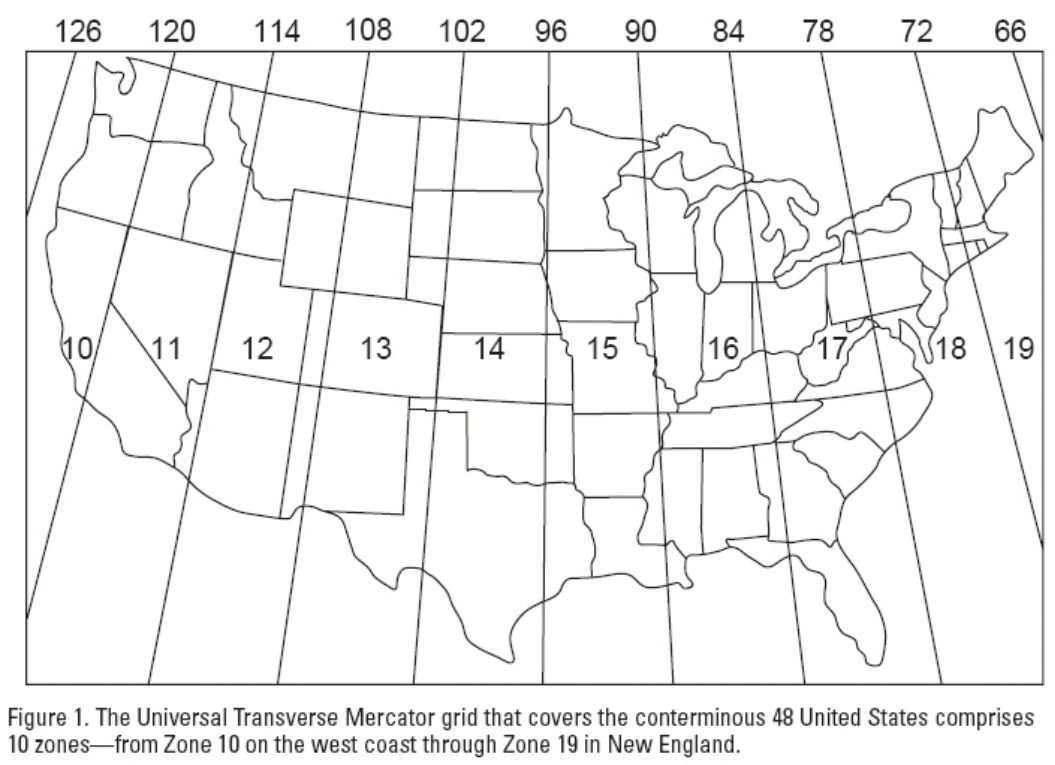
Somebody asked about UTM measurements south of the equator… UTM has a north and south zone, each are measurements from the equator… ESRI: What are map projections? The above links you to ESRI’s excellent explanation of map projections, coordinate systems, spatial references, and related ArcGIS tasks. You need to […]
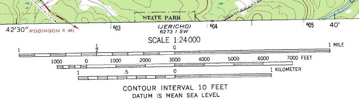
Geog. Info. Sys. Basics (ch 2.2) Scale… (Map Scale, Analysis Scale) Map scale (verbal scale, graphic scale, representative fraction) Map scales are an expression of the numerical relationship between measurements made on the map (the map units) and the same measurements made on the ground (the ground units). Verbal Scale: A […]
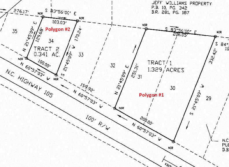
Geographic Information System Basics (ch1.2) Location, Direction & Distance… (Over There, Just Up The Road, Not Too Far) RELATIVE LOCATION / RELATIVE DIRECTION / RELATIVE DISTANCE Often times, you will be tasked with converting relative mappings to absolute mappings. Consider the following Ryan property survey. The site has been […]