
Useful YouTube introduction to coordinate systems and UTM projection Four parts of most Earth coordinate systems: To ‘figure out the size and shape of Earth’, we must define a reference ellipsoid – Done so by averaging the geoid surface (geoid is an imaginary surface of constant gravity) Next, break the Earth’s […]
Monthly Archives: January 2017
6 posts
Follow-up of Monday’s Lab Photoscan Workflow: Add Photos (Align Photos*) Insert/Locate ground control points Align Photos (again) Build Dense Cloud Build Mesh Build DEM Build Orthomosaic Export DEM and Ortho Problem with GPS Altitude EXIF tag lab data set: Current Phantom 4 firmware populates the GPS Altitude tag with the […]
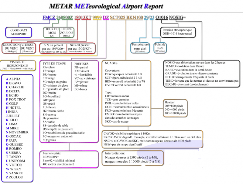
METARs: Routine Surface Observations RP101 3.1 METAR Cheat Sheet aviationweather.gov METAR issued every 55 minutes CB = cumulonimbus = thunder showers Ceiling is the lowest broken or overcast layer (few and scattered is not considered when determining the ceiling) cloud heights are reported in hundreds of feet above ground […]
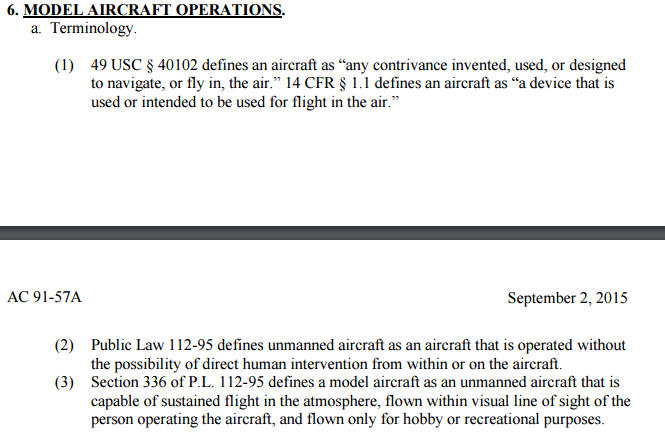
(3) Little bit of background Congress recognized the FAA’s authority to regulate airspace use, management, and efficiency, air traffic control safety, navigational facilities, and aircraft noise at its source (49 U.S.C. §§ 40103, 44502, and 44701-44735. 1978) The FAA Modernization and Reform Act of 2012(1a, 1b), the FMRA, […]
Instructor: Dr. Roger ‘Tripp’ Lowe (lowe@uga.edu) Lectures: Wed & Fri (9:05 – 9:55) in 1-210 Labs: Mon (1:25 – 3:20) in room 4-419 Course Objectives: I plan to introduce you to the unique aspects of integrating small unmanned aircraft systems (sUAS) into the sustainable natural resource management workflow. We will explore […]
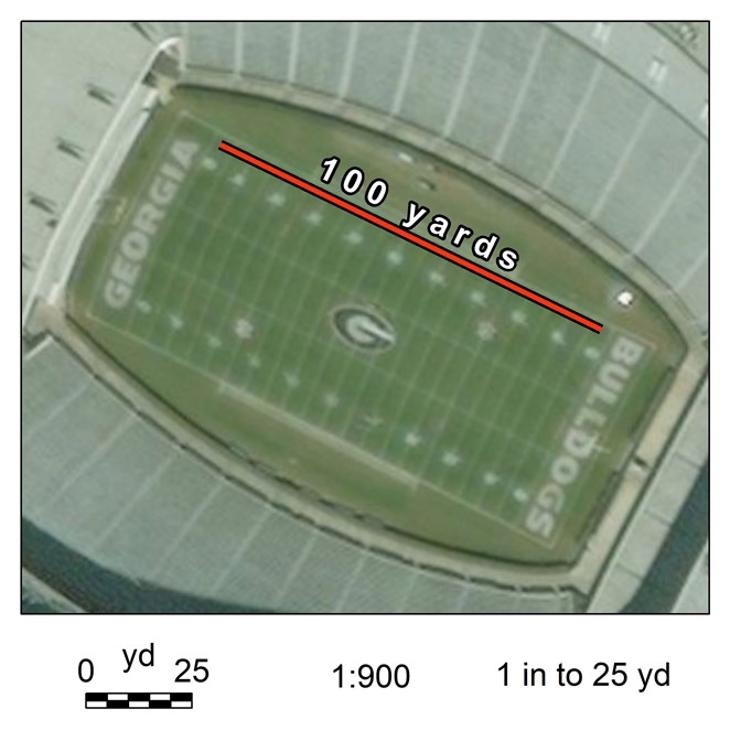
Geog. Info. Sys. Basics (ch 2.2) Scale… (Map Scale, Analysis Scale) Map scale (verbal scale, graphic scale, representative fraction) Map scales are an expression of the numerical relationship between measurements made on the map (the map units) and the same measurements made on the ground (the ground units). Verbal […]