
Vector Data Creation – Digitizing I Digitizing: “the art and science of connect-the-dots” (Lowe 2016) Digitizing in ArcMap is fairly simple. You: create a point, line, or polygon feature class (inside your file geodatabase) * this includes adding the appropriate fields in the attribute table load a georeferenced data source […]
FANR3800
6 posts
Global Positioning System (GPS) About: The 24 satellites that make up the GPS space segment are orbiting the earth 11,000 to 12,000 miles above us. They are constantly moving, making two complete orbits in less than 24 hours. These satellites are travelling at speeds of roughly 7,000 miles an […]
Sample Data Here Overlay Analysis We have already reviewed one overlay (selection) analysis tool – Select By Location. Recall, with this method, you select whole records in one layer that are spatially related in some manner (intersects, within a distance…, center is within…, etc) to another layer (Select By Location). This method works […]
(http://www.gsd.harvard.edu/gis/manual/projections/) Things you should know about coordinate systems and ArcGIS: In ArcMap, the coordinate system consists of a projection, a datum, and a unit of measure. To make things easy for the user, ArcMap has many of them already defined in the software. Latitude/Longitude is considered an unprojected coordinate system […]
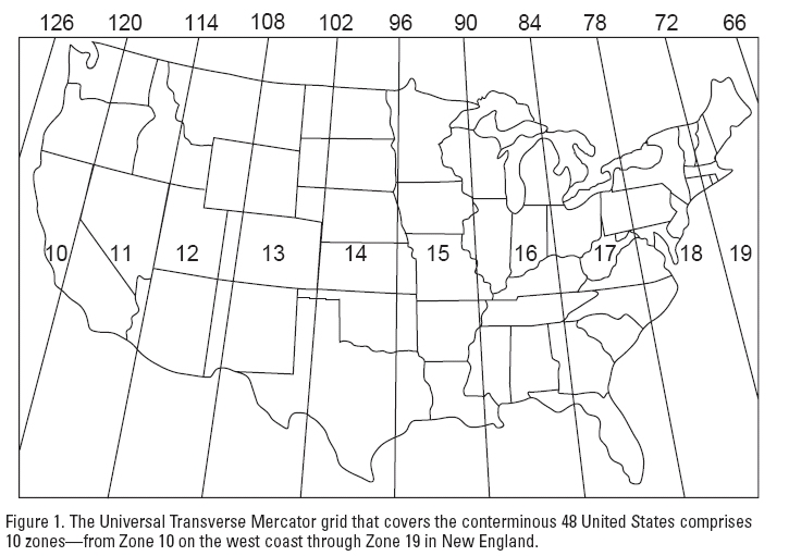
Useful YouTube introduction to coordinate systems and UTM projection Four parts of most Earth coordinate systems: To ‘figure out the size and shape of Earth’, we must define a reference ellipsoid – Done so by averaging the geoid surface (geoid is an imaginary surface of constant gravity) Next, break the Earth’s […]
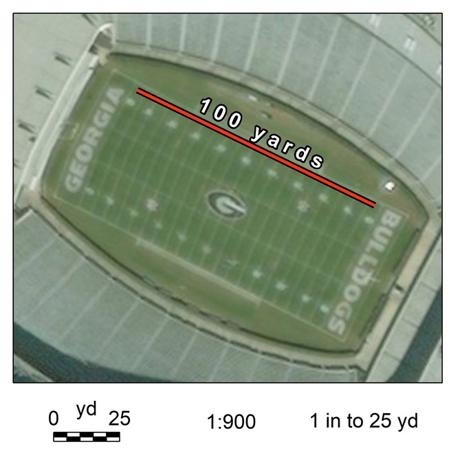
Geog. Info. Sys. Basics (ch 2.2) Scale… (Map Scale, Analysis Scale) Map scale (verbal scale, graphic scale, representative fraction) Map scales are an expression of the numerical relationship between measurements made on the map (the map units) and the same measurements made on the ground (the ground units). Verbal […]