
Sectionals, once again: MzeroA Flight Training – sectionals How to read a VFR sectional chart: https://www.youtube.com/watch?v=NEp1K-TCmD8 Aeronautical Chart User’s guide (Chart symbols): https://www.faa.gov/air_traffic/flight_info/aeronav/digital_products/aero_guide/media/editions/16Jul2020/cug-complete.pdf
Yearly Archives: 2021
6 posts
If you don’t already have the input data, HERE it is. The clip layer is here: CLIPLAYER. Now that you have a good idea of how the various parameters affect the final output, I have modified the code so that we input the parameters near the beginning of the code […]
LINK TO PART I UAV-Mapper output (orthophoto, surface model, LAS) from the first part are stored in your working directory in a folder named “5_Products”. For this lab, however, use the point cloud I provide in the data you downloaded at the beginning of part 1: "clpSG_PointCloud_th001.las" which is saved […]
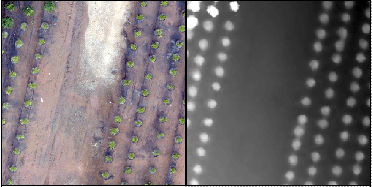
LINK TO PART II Recall the tree orchard site we’ve been looking at. This site is relatively flat with distinct (potted) objects. In this lab, I will attempt to lead you through an R-based analysis with the goal of segmenting the landscape (individual potted plants). Before you begin in R, […]
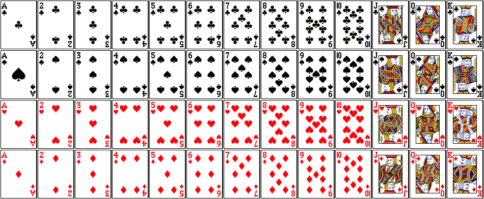
RECALL: ATTRIBUTE QUERY OPERATORS – AND, OR GIS Data Layer: LayerName: PlayingCards Description: There are 52 polygons; each polygon has one record in the attribute table Fields in the attribute table: SUITE: club, spade, heart, diamond COLOR: red, black FACECARD: yes, no VALUE: 1 – 13 (ace = 1, […]
Lab 9 Data Link (clp_tls.laz). This is a large dataset, have patience!!! The “LAZ” file is a common point cloud file format storage type. You read a LAZ the same way you read a LAS – you process it using the same approach. See the LAND USE, CARBON & EMISSION […]