There are two components to lab 6. First you will dump your 10 Garmin GPSMAP64 GPS data points and will view them in ArcMap. After this, you will use both the Garmin and the Trimble units to map the greenspace in front of Warnell. Your deliverable for this […]
Monthly Archives: September 2017
6 posts
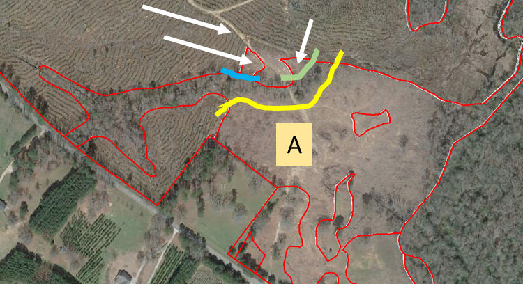
The southeastern portion requires some updating… Start editing the cover type layer Select polygon A and grab the cut tool Cut along the yellow line, then the blue line, then the green line Clear the selection, then select only the 3 polygons marked with an arrow above Merge […]
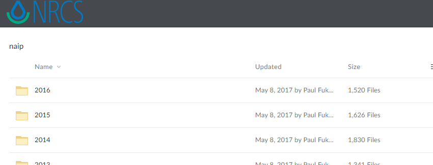
Download NAIP orthophotos NRCS Geospatial Data Gateway (https://datagateway.nrcs.usda.gov/) Follow the “Direct NAIP Download” link (right-hand side of the page under the ‘I Want To’ heading) Follow the “National Ag. Imagery Program County Mosaic” link to expose the NRCS NAIP repository (top link on the page) The NAIP imagery is now […]
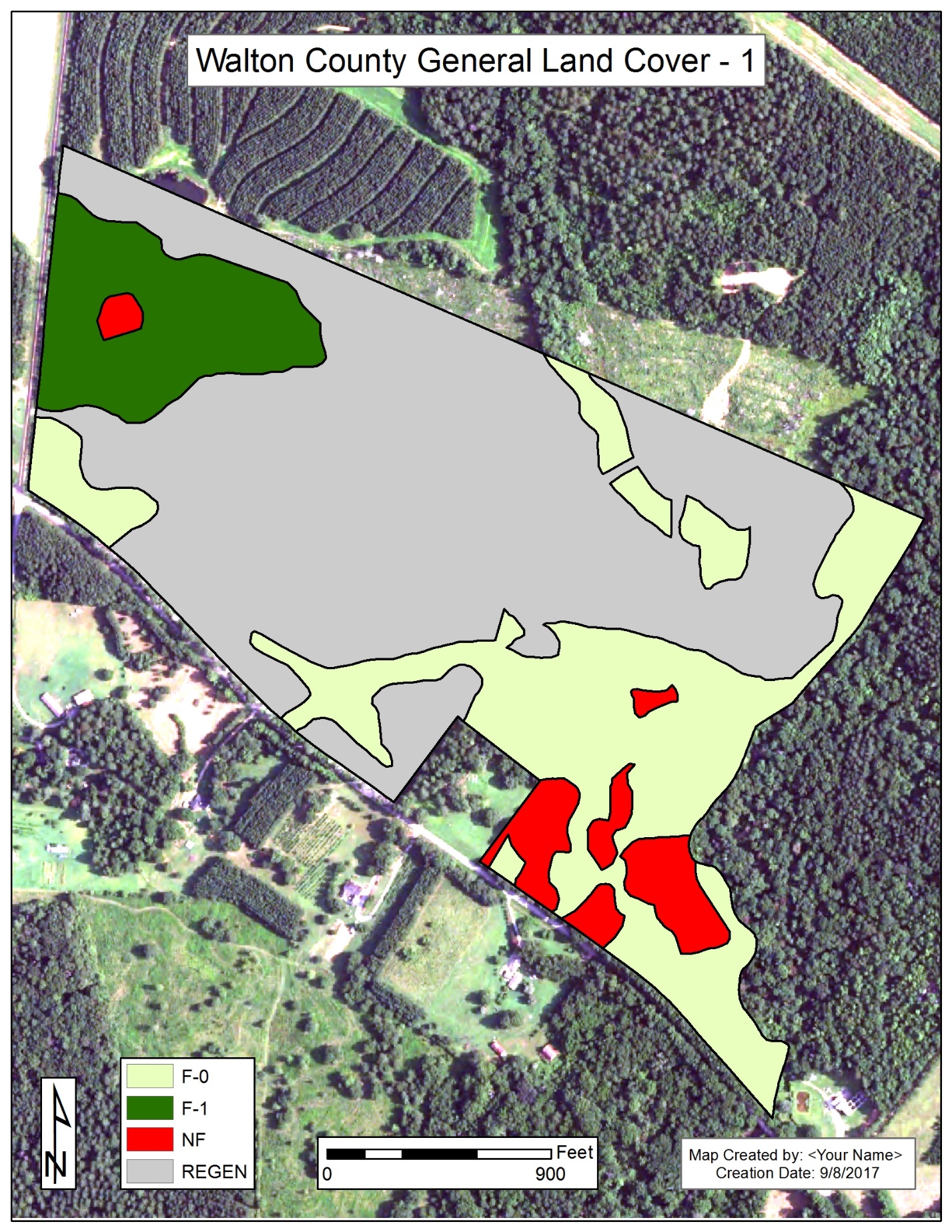
Lab 4: Determine area of forested-0 (planted pine & hardwoods), forested-1 (thinned pine), regeneration, and nonforest types, and generate a map to show where these stands are located. To eliminate any confusion (previous mess-ups), I created a lab 4 file geodatabase for you – you will be using the Walton […]

Most of the issues some of y’all experienced Wednesday were due to poor workspace management. Each of these issues is solved by creating a workspace folder on the c:\ drive and saving/copying/exporting/… everything to it. This is what I saw Wednesday: Not correctly copying existing workspace from your network drive […]
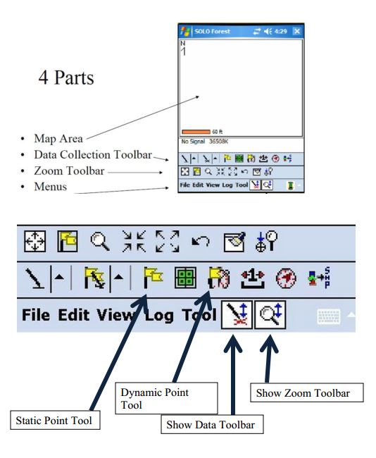
Vector Data Creation – Digitizing I Digitizing: “the art and science of connect-the-dots” (Lowe 2016) Digitizing in ArcMap is fairly simple. You: create a point, line, or polygon feature class (inside your file geodatabase) * this includes adding the appropriate fields in the attribute table load a georeferenced data source […]