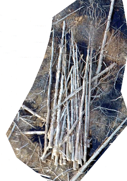
Improvement of clip by extent example from Wednesday… The following code clips the LAS to the boundary of the shapefile. (example data) library(lidR) library(rgdal) setwd("c:/temp/sf/") tdat<- readLAS("sp2_pcloud.las") plot(tdat) tpoly<- readOGR( ".","AnalysisUnit") clpdat <- lasclipPolygon(tdat, tpoly@polygons[[1]]@Polygons[[1]]@coords[,1], tpoly@polygons[[1]]@Polygons[[1]]@coords[,2]) plot(clpdat) COARSE WOODY DEBRIS EXAMPLE: Task at hand is to determine […]
Monthly Archives: March 2018
7 posts
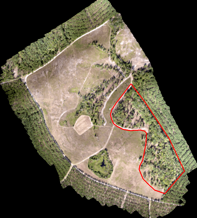
Today’s scenario. We need to perform a similar analysis on a site I flew last summer. We are only interested in the area outlined in red (screenshot below). INPUT DATA: Input LAS: sp2_pcloud.las (DropBox Link) Processing extent: AnalysisUnit.shp R WORKFLOW: Clip input data to processing extent Classify ground points Create […]
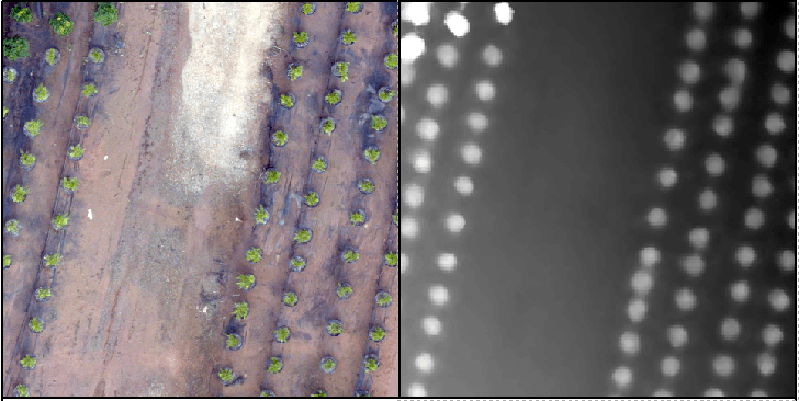
Recall the tree orchard site we’ve been looking at. This site is relatively flat with distinct (potted) objects. In this lab, I will attempt to lead you through an R-based analysis with the goal of segmenting the landscape (individual potted plants). INPUT DATA: Lab data is linked HERE. Use the […]
In this lab, you will generate a point cloud and an orthophoto from photos captured during one of my UAV flights last November. You will use the LiDAR toolset in Global Mapper to generate a bare ground “terrain” model and a “surface” model (includes trees, stumps, buildings, etc). ——————————————————————————— Create […]

Kinematic Analysis of a Rock Slope at Strecno Castle (Slovakia) Based on the Processing of the Point Cloud Generated by UAV Photogrammetry https://link.springer.com/chapter/10.1007/978-3-319-53498-5_48 An investigation of image processing techniques for substrate classification based on dominant grain size using RGB images from UAV https://www.tandfonline.com/doi/abs/10.1080/01431161.2016.1249309 SPECIAL ISSUE: Imaging and […]
We’ll get back to project planning Friday. In the meantime, lets review Monday’s lab and spatial data modeling in general. The most exciting phrase to hear in science, the one that heralds new discoveries, is not "Eureka!", but "That's funny..." (Isaac Asimov) In my case, the phrase is “…hmmm. That’s […]
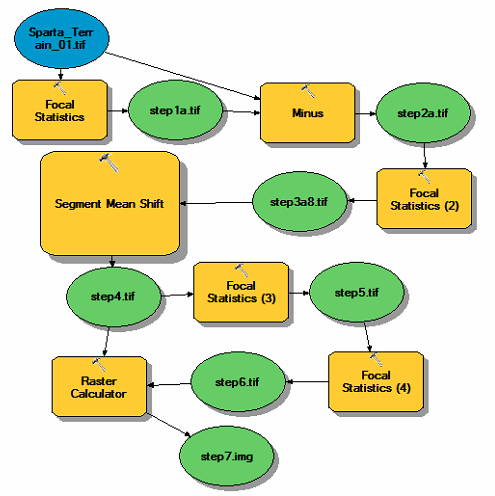
Download the Lab 7 Data Here. In this lab, you will step through a series of raster calculations to create a canopy model. Processing this type of data is much vaster when working with the raster data type; resist the urge to convert to vector until the very […]