In practice Select a coordinate system with the least distortion for your project area When working across states or continents, the distortion (aka error) could be very large If you are unsure what CS to use, look to see what coordinate system the ‘experts’ use when working in the same […]
FALL2018
26 posts

Lab 2 Review… First step is to prepare your input data for analysis. Your inputs are: landcover: polygon shapefile in NAD_1927_Hotine_Oblique_Mercator_Azimuth_Natural_Origin coordinate system (projected coordinate system) owl_nest_locs.csv: tabular file containing latitude/longitude coordinates (geographic coordinate system) of nest locations Before you proceed, you must ensure all of your inputs are cast in […]
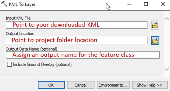
SHORT VERSION… QPublic parcel to ArcMap… Find parcel on QPublic site Search by Owner Name, parcel number, or road name After a successful parcel query, click the Map link at the top of the page to show QPublic’s map view. Download the parcel in KML format Hit the […]
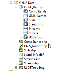
Output paths Screen shots below show my project’s working directory: …/OcNF_Data/ . The directory contains: Five shapefiles, one raster, and one DBF table, and One file geodatabase, OcNF_Data.ddb that holds 5 (vector) feature classes, one raster, and one table ArcMap Catalog listing: Windows File Explorer listing: Where should you save […]
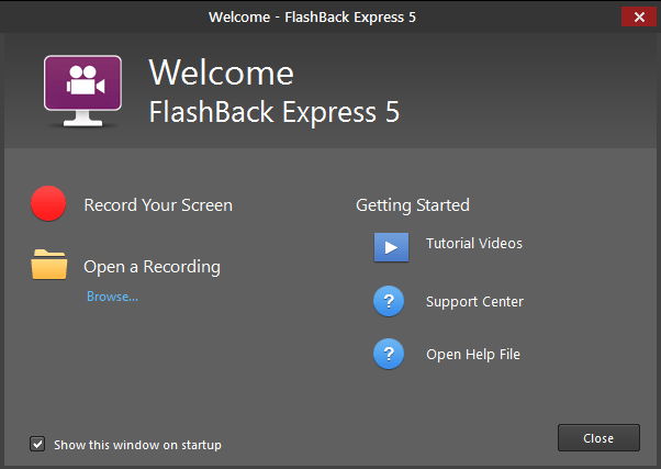
(NOTE: IceCream Apps screen recorder is another screen recorder that is pretty easy to use) I have installed FlashBack Express (FBE) on the GIS lab machines. If you do not already have a favorite screen recording software, I suggest using it. Operation is simple: Stage your ArcMap project or […]
I will provide a FlipGrid link for each assignment. The password is fanr3800. Assignment 1 – Student introductions: I would like you to create a short video where you introduce yourself to the class. The video should include your name, major and/or emphasis, why you decided to enroll in Warnell, and […]
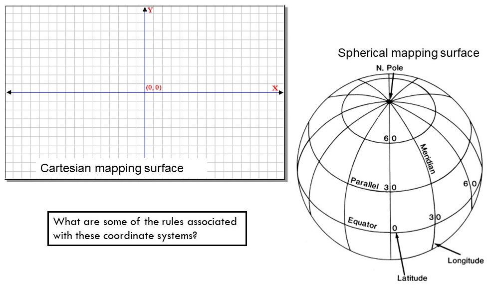
Mapping Surfaces: (Bolstad, Ch. 2, 29 – 39) Spatial Referencing Systems (Bolstad, Ch. 3, 85 – 146) Coordinate System Jargon: geoid, datum, projection ( YouTube Video ) Spheroids, Ellipsoid, and Geoid – GIS Fundamentals and Mapping ( YouTube Video ) Recall that: points are represented by an X&Y coordinate lines […]
As I documented in the course syllabus, your Video Assignment grade is comprised of two tasks. The first part is to video-document the 38 common ArcGIS tasks listed below. (The second part will be administered during the course’s scheduled final exam period – See Syllabus). Please use the GIS data […]

Spatial Analysis for Natural Resources Syllabus – Fall 2018 Instructor: Dr. Tripp Lowe (lowe@uga.edu) Office: WSFNR 4-514 (542-1074) Office Hours: Teaching Assistants: Karuna Paudel Office: Warnell Email: karunapaudel@uga.edu Office Hours: TBA Tabby Phillips Office: Warnell Email: orcaluvr@uga.edu Office Hours: TBA Meeting Times: Class: Building 1 Room 304, MW 8:00 – 8:50am […]
Data Driven Pages (MapBooks) Exercise Data Here+ EXERCISE DATA HERE #2 (USE THIS ONE) ESRI’s What are Data Driven Pages? Data Driven Pages allow you to quickly and easily create a series of layout pages from a single map document. A feature layer, or index layer, divides the map into sections based […]