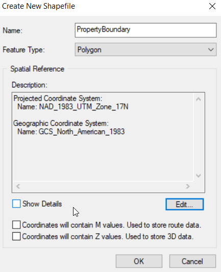
Create new shapefile (from ArcMap) Windows pull-down > Catalog In the Catalog navigate to your working directory right-click on your working directory > New > Shapefile Name it You are creating a polygon Set the Spatial Reference (coordinate system) Edit > Projected > UTM > NAD 1983 > NAD_1983_UTM_Zone_17N You […]
Monthly Archives: August 2018
11 posts

Part I of your course notebook is due October 19 by midnight. Upload your work to the How-To Notebook Part I ELC assignment dropbox. I might move a topic to Part II if we don’t cover it before the document is due. I will announce any changes during […]
To start with, we will look at this data layer. I want to demonstrate why we might be concerned about distortion in our data due to the user’s choice of coordinate system. Have a little patience, I will release the lab data in a few minutes. Close this project when […]
In practice Select a coordinate system with the least distortion for your project area When working across states or continents, the distortion (aka error) could be very large If you are unsure what CS to use, look to see what coordinate system the ‘experts’ use when working in the same […]
Lab 2 Review… First step is to prepare your input data for analysis. Your inputs are: landcover: polygon shapefile in NAD_1927_Hotine_Oblique_Mercator_Azimuth_Natural_Origin coordinate system (projected coordinate system) owl_nest_locs.csv: tabular file containing latitude/longitude coordinates (geographic coordinate system) of nest locations Before you proceed, you must ensure all of your inputs are cast in […]
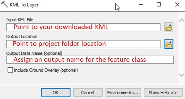
SHORT VERSION… QPublic parcel to ArcMap… Find parcel on QPublic site Search by Owner Name, parcel number, or road name After a successful parcel query, click the Map link at the top of the page to show QPublic’s map view. Download the parcel in KML format Hit the […]
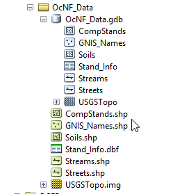
Output paths Screen shots below show my project’s working directory: …/OcNF_Data/ . The directory contains: Five shapefiles, one raster, and one DBF table, and One file geodatabase, OcNF_Data.ddb that holds 5 (vector) feature classes, one raster, and one table ArcMap Catalog listing: Windows File Explorer listing: Where should you save […]
Click HERE to access the lab data repository!!! You can click HERE too Nothing will happen If you click here. Download OcNF_Data.gdb2.zip from the data repository and set up your project workspace on the E:\ drive (even though the lab document or screen shots may reference […]
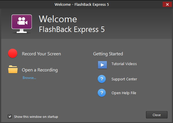
(NOTE: IceCream Apps screen recorder is another screen recorder that is pretty easy to use) I have installed FlashBack Express (FBE) on the GIS lab machines. If you do not already have a favorite screen recording software, I suggest using it. Operation is simple: Stage your ArcMap project or […]
I will provide a FlipGrid link for each assignment. The password is fanr3800. Assignment 1 – Student introductions: I would like you to create a short video where you introduce yourself to the class. The video should include your name, major and/or emphasis, why you decided to enroll in Warnell, and […]